
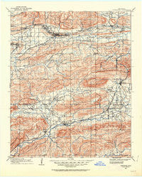
~ Tuskahoma OK topo map, 1:125000 scale, 30 X 30 Minute, Historical, 1908, updated 1964
Tuskahoma, Oklahoma, USGS topographic map dated 1908.
Includes geographic coordinates (latitude and longitude). This topographic map is suitable for hiking, camping, and exploring, or framing it as a wall map.
Printed on-demand using high resolution imagery, on heavy weight and acid free paper, or alternatively on a variety of synthetic materials.
Topos available on paper, Waterproof, Poly, or Tyvek. Usually shipping rolled, unless combined with other folded maps in one order.
- Product Number: USGS-5473089
- Free digital map download (high-resolution, GeoPDF): Tuskahoma, Oklahoma (file size: 7 MB)
- Map Size: please refer to the dimensions of the GeoPDF map above
- Weight (paper map): ca. 55 grams
- Map Type: POD USGS Topographic Map
- Map Series: HTMC
- Map Verison: Historical
- Cell ID: 66827
- Scan ID: 802434
- Imprint Year: 1964
- Survey Year: 1897
- Datum: NAD27
- Map Projection: Polyconic
- Map published by United States Geological Survey
- Map Language: English
- Scanner Resolution: 508 dpi
- Map Cell Name: Tuskahoma
- Grid size: 30 X 30 Minute
- Date on map: 1908
- Map Scale: 1:125000
- Geographical region: Oklahoma, United States
Neighboring Maps:
All neighboring USGS topo maps are available for sale online at a variety of scales.
Spatial coverage:
Topo map Tuskahoma, Oklahoma, covers the geographical area associated the following places:
- Talihina - Lamberson - Chilli - Drumb - Kiamichi - Clayton - Yanush - Veterans Colony - Albion - Tuskahoma - Center Point - Red Oak - Wilburton - Lutie - Denman - Panola - Bengal - Stanley - Sardis - Compton - Gowen - Fewell - Damon - Bowers - Patterson - Degnan - Higgins
- Map Area ID: AREA3534.5-95.5-95
- Northwest corner Lat/Long code: USGSNW35-95.5
- Northeast corner Lat/Long code: USGSNE35-95
- Southwest corner Lat/Long code: USGSSW34.5-95.5
- Southeast corner Lat/Long code: USGSSE34.5-95
- Northern map edge Latitude: 35
- Southern map edge Latitude: 34.5
- Western map edge Longitude: -95.5
- Eastern map edge Longitude: -95


