
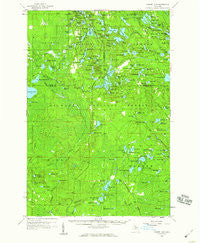
~ Corner Lake MI topo map, 1:62500 scale, 15 X 15 Minute, Historical, 1958, updated 1959
Corner Lake, Michigan, USGS topographic map dated 1958.
Includes geographic coordinates (latitude and longitude). This topographic map is suitable for hiking, camping, and exploring, or framing it as a wall map.
Printed on-demand using high resolution imagery, on heavy weight and acid free paper, or alternatively on a variety of synthetic materials.
Topos available on paper, Waterproof, Poly, or Tyvek. Usually shipping rolled, unless combined with other folded maps in one order.
- Product Number: USGS-5442516
- Free digital map download (high-resolution, GeoPDF): Corner Lake, Michigan (file size: 9 MB)
- Map Size: please refer to the dimensions of the GeoPDF map above
- Weight (paper map): ca. 55 grams
- Map Type: POD USGS Topographic Map
- Map Series: HTMC
- Map Verison: Historical
- Cell ID: 52948
- Scan ID: 278064
- Imprint Year: 1959
- Woodland Tint: Yes
- Aerial Photo Year: 1953
- Field Check Year: 1958
- Datum: NAD27
- Map Projection: Polyconic
- Map published by United States Geological Survey
- Map Language: English
- Scanner Resolution: 600 dpi
- Map Cell Name: Corner Lake
- Grid size: 15 X 15 Minute
- Date on map: 1958
- Map Scale: 1:62500
- Geographical region: Michigan, United States
Neighboring Maps:
All neighboring USGS topo maps are available for sale online at a variety of scales.
Spatial coverage:
Topo map Corner Lake, Michigan, covers the geographical area associated the following places:
- Petoskey Hunting Club - Squaw Lake - Mahskeekee Lake - Connor Lake - River Slough - Dana Lake - Tie Hill Lookout Tower - Scout Lake - Wide Water Campground - Deep Lake - West Lake - Norway Lake - Swan Lake - Hike Lake - Mink Lake - Hiawatha National Forest - Big Island Lake Wilderness - Squaw Ponds - Rim Lake - West Branch Sturgeon River - Ironjaw Lake - Uno Post Office (historical) - Hidden Lake - Van Winkle Lake - Wolf Lake - Man Lake - Shoe Pac Lake - Brevick Lake - Johnson Creek - Molly Lake - Turtle Lake - Kimble Lake - Carr Ponds - Billy Good Lake - Camp Red Buck - Temple Lake - Mowe Lake - Dipper Lake - Carr Lake - Square Lake - Petes Lake Recreation Area - Cluster Lakes - Waco Lookout Tower - Skeels Pond - Snipe Lake - Council Lake - Onega Lake - Camp K Lake - Vista Lake - Big Island Lake Portage Canoe Trail - Tie Lake - Gooseneck Lake - Rumble Lake - Cookson Lake - Townline Lake - Little Indian River - Carp Lake - Pan Lake - Toms Lake - McKeever Lake - Big Island Lake - Spud Lake - Gleason Lake - Upper Lake - McComb Lake - Baldy Lake - Grants Lake - Cucumber Lake - Straits Lake - Chicago Lake - Blue Lake - Dam Lake - Blue Joe Lake - Polack Lake - Stevens Lake - Irwin Lake - Klondike Lake - Camp Twentysix - Ganamush Lake - Spot Lake - Center Lake - Corner Lake - Town Lake - Bar Lake - Mike White Lake - Lakes Camp - Highbridge Lake - Muskrat Lake - Camp Fortyone Lake - Palos Camp - Lion Lake - Mink Creek - Dinner Lake - Triangle Lake - Lake Twentythree - Moccasin Lake Picnic Area - Spring Lake - Frying Pan Lake - Coattail Lake - Pike Lake
- Map Area ID: AREA46.2546-86.75-86.5
- Northwest corner Lat/Long code: USGSNW46.25-86.75
- Northeast corner Lat/Long code: USGSNE46.25-86.5
- Southwest corner Lat/Long code: USGSSW46-86.75
- Southeast corner Lat/Long code: USGSSE46-86.5
- Northern map edge Latitude: 46.25
- Southern map edge Latitude: 46
- Western map edge Longitude: -86.75
- Eastern map edge Longitude: -86.5


