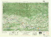
~ Russellville AR topo map, 1:250000 scale, 1 X 2 Degree, Historical, 1956
Russellville, Arkansas, USGS topographic map dated 1956.
Includes geographic coordinates (latitude and longitude). This topographic map is suitable for hiking, camping, and exploring, or framing it as a wall map.
Printed on-demand using high resolution imagery, on heavy weight and acid free paper, or alternatively on a variety of synthetic materials.
Topos available on paper, Waterproof, Poly, or Tyvek. Usually shipping rolled, unless combined with other folded maps in one order.
- Product Number: USGS-5430128
- Free digital map download (high-resolution, GeoPDF): Russellville, Arkansas (file size: 28 MB)
- Map Size: please refer to the dimensions of the GeoPDF map above
- Weight (paper map): ca. 55 grams
- Map Type: POD USGS Topographic Map
- Map Series: HTMC
- Map Verison: Historical
- Cell ID: 68997
- Scan ID: 260605
- Woodland Tint: Yes
- Field Check Year: 1953
- Datum: Unstated
- Map Projection: Transverse Mercator
- Map published by United States Army Corps of Engineers
- Map published by United States Army
- Map Language: English
- Scanner Resolution: 600 dpi
- Map Cell Name: Russellville
- Grid size: 1 X 2 Degree
- Date on map: 1956
- Map Scale: 1:250000
- Geographical region: Arkansas, United States
Neighboring Maps:
All neighboring USGS topo maps are available for sale online at a variety of scales.
Spatial coverage:
Topo map Russellville, Arkansas, covers the geographical area associated the following places:
- May (historical) - Eglantine - Old Linder (historical) - East Mountain (historical) - Mixon - Mountain Grove - Newnata - Lick Mountain - Carbon City - Shiloh - Holland - Sommer (historical) - Otto - Meg - Townsley (historical) - Pine Mountain (historical) - Mount Vernon - Southside - Friley - Gillian Settlement - Williams Gulf (historical) - Pekin (historical) - Arthur - New Spadra - Morning Star - Zion Hill - Pless (historical) - Choctaw - Holly Springs - Dentontown (historical) - Hagarville - Cass - Piney - Garber - Archey (historical) - Cypress Valley - Walnut Grove - Partain - Fairfield Bay - Piercetown - Fresno (historical) - Miller (historical) - Wayton - Plant - Worthen - Knoxville Junction - Ratcliff - Index (historical) - Lewisburg - Soda Valley - West Cobb - Laurel (historical) - Union - Pleasant Valley - Cotton Town - Nail - Etna - Green Tree - Treat - Tilly - Blackwell - Sand Ridge - Saltillo - Dahoma (historical) - Birta - Aurora - Bertha - Hector - Felkner Town - Quarry Heights - Martinville - Choctaw Pines - Acklin Gap (historical) - Old Botkinburg - Tokalon - Pettigrew - Leta (historical) - Sweet Home - Ruddells (historical) - McDermott Addition - Sulphur Springs - Bristol (historical) - Ludwig - Houston - Moreland - Barren Hollow - Lutherville - Sylamore - Edwards Junction - Weathers - Victor - Ella (historical) - Enders - Belk Corner - Fairview - Stafford - Sandtown (historical) - Midway - Buttermilk - Fallsville
- Map Area ID: AREA3635-94-92
- Northwest corner Lat/Long code: USGSNW36-94
- Northeast corner Lat/Long code: USGSNE36-92
- Southwest corner Lat/Long code: USGSSW35-94
- Southeast corner Lat/Long code: USGSSE35-92
- Northern map edge Latitude: 36
- Southern map edge Latitude: 35
- Western map edge Longitude: -94
- Eastern map edge Longitude: -92

