
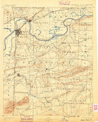
~ Fort Smith AR topo map, 1:125000 scale, 30 X 30 Minute, Historical, 1890
Fort Smith, Arkansas, USGS topographic map dated 1890.
Includes geographic coordinates (latitude and longitude). This topographic map is suitable for hiking, camping, and exploring, or framing it as a wall map.
Printed on-demand using high resolution imagery, on heavy weight and acid free paper, or alternatively on a variety of synthetic materials.
Topos available on paper, Waterproof, Poly, or Tyvek. Usually shipping rolled, unless combined with other folded maps in one order.
- Product Number: USGS-5429916
- Free digital map download (high-resolution, GeoPDF): Fort Smith, Arkansas (file size: 7 MB)
- Map Size: please refer to the dimensions of the GeoPDF map above
- Weight (paper map): ca. 55 grams
- Map Type: POD USGS Topographic Map
- Map Series: HTMC
- Map Verison: Historical
- Cell ID: 65510
- Scan ID: 260480
- Survey Year: 1887
- Datum: Unstated
- Map Projection: Unstated
- Map published by United States Geological Survey
- Map Language: English
- Scanner Resolution: 600 dpi
- Map Cell Name: Fort Smith
- Grid size: 30 X 30 Minute
- Date on map: 1890
- Map Scale: 1:125000
- Geographical region: Arkansas, United States
Neighboring Maps:
All neighboring USGS topo maps are available for sale online at a variety of scales.
Spatial coverage:
Topo map Fort Smith, Arkansas, covers the geographical area associated the following places:
- Haroldton - Furry - Lucas - Massard - Barling - Fox Hill - Boothe - Buell - Rena - Kings Creek (historical) - Pocola - Charleston - New Jenny Lind - Ursula - Cross Lanes - Kibler - Old Jenny Lind - Hartford - Dyer - Fort Chaffee - Slaytonville - New Town - Arkola - Yoestown - Greenwood - Smeltzer - Shibley - Bluff Ridge (historical) - Greenwood - Crossroads - Saw Mill - Oak Grove - New Haroldton - Concord - South Fort Smith - Lavaca - Enterprise - Alma - Eastgate Place - Central City - Pleasant View - Catcher - Greenwood Junction - Bloomer - Jenson - Doubleday (historical) - Mansfield - Leon (historical) - Westville - Barber - Anice (historical) - Diamond Grove - Dill Place (historical) - Rock Island - Bashe - Meadows - West Fort Smith - Hill - Dora - Hackett - Burnville - Jenny Lind - West Hartford - Auburn (historical) - Thessing (historical) - Prairie Creek - Cedar Knobb - Cedars - Wright Town - Ione - Beverly - Frog Town - Arkoma - Huntington - Excelsior - Vesta - Abbott - Dayton - Washburn - Riverdale - Moffett - Cavanaugh - Lewis - Elm Park - Liberty - White Bluff - Milltown - Fidelity (historical) - Oak Park - Big Rock - Carnis - Burna - Witcherville - Bonanza - Van Buren - Mill Creek - Montreal - Fort Smith - Crescent - Island
- Map Area ID: AREA35.535-94.5-94
- Northwest corner Lat/Long code: USGSNW35.5-94.5
- Northeast corner Lat/Long code: USGSNE35.5-94
- Southwest corner Lat/Long code: USGSSW35-94.5
- Southeast corner Lat/Long code: USGSSE35-94
- Northern map edge Latitude: 35.5
- Southern map edge Latitude: 35
- Western map edge Longitude: -94.5
- Eastern map edge Longitude: -94


