
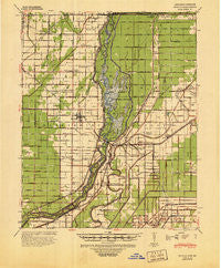
~ Manila AR topo map, 1:62500 scale, 15 X 15 Minute, Historical, 1941, updated 1945
Manila, Arkansas, USGS topographic map dated 1941.
Includes geographic coordinates (latitude and longitude). This topographic map is suitable for hiking, camping, and exploring, or framing it as a wall map.
Printed on-demand using high resolution imagery, on heavy weight and acid free paper, or alternatively on a variety of synthetic materials.
Topos available on paper, Waterproof, Poly, or Tyvek. Usually shipping rolled, unless combined with other folded maps in one order.
- Product Number: USGS-5429406
- Free digital map download (high-resolution, GeoPDF): Manila, Arkansas (file size: 9 MB)
- Map Size: please refer to the dimensions of the GeoPDF map above
- Weight (paper map): ca. 55 grams
- Map Type: POD USGS Topographic Map
- Map Series: HTMC
- Map Verison: Historical
- Cell ID: 57098
- Scan ID: 260167
- Imprint Year: 1945
- Woodland Tint: Yes
- Edit Year: 1941
- Datum: NAD
- Map Projection: Polyconic
- Map published by United States Army Corps of Engineers
- Map published by United States Department of War
- Map Language: English
- Scanner Resolution: 600 dpi
- Map Cell Name: Manila
- Grid size: 15 X 15 Minute
- Date on map: 1941
- Map Scale: 1:62500
- Geographical region: Arkansas, United States
Neighboring Maps:
All neighboring USGS topo maps are available for sale online at a variety of scales.
Spatial coverage:
Topo map Manila, Arkansas, covers the geographical area associated the following places:
- Boynton - Pawheen - Half Moon - Manila - Floodway - Big Lake - Dell - Buckeye - Pettyville - Little River - Brown (historical) - McFerrin - Garson - Wilson Junction - Shady Grove - Mandalay - Stark City - Poplar Corner - Midway - Shonyo (historical) - Lost Cane - Lennie - Victoria - Lowden - Rington - Whistleville - Hightower - Turner - Little Green Store - Dearman - Roseland - Arkmo - Woodland Corner
- Map Area ID: AREA3635.75-90.25-90
- Northwest corner Lat/Long code: USGSNW36-90.25
- Northeast corner Lat/Long code: USGSNE36-90
- Southwest corner Lat/Long code: USGSSW35.75-90.25
- Southeast corner Lat/Long code: USGSSE35.75-90
- Northern map edge Latitude: 36
- Southern map edge Latitude: 35.75
- Western map edge Longitude: -90.25
- Eastern map edge Longitude: -90


