
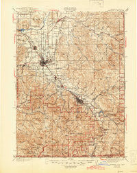
~ Medford OR topo map, 1:125000 scale, 30 X 30 Minute, Historical, 1938, updated 1945
Medford, Oregon, USGS topographic map dated 1938.
Includes geographic coordinates (latitude and longitude). This topographic map is suitable for hiking, camping, and exploring, or framing it as a wall map.
Printed on-demand using high resolution imagery, on heavy weight and acid free paper, or alternatively on a variety of synthetic materials.
Topos available on paper, Waterproof, Poly, or Tyvek. Usually shipping rolled, unless combined with other folded maps in one order.
- Product Number: USGS-5424764
- Free digital map download (high-resolution, GeoPDF): Medford, Oregon (file size: 12 MB)
- Map Size: please refer to the dimensions of the GeoPDF map above
- Weight (paper map): ca. 55 grams
- Map Type: POD USGS Topographic Map
- Map Series: HTMC
- Map Verison: Historical
- Cell ID: 66026
- Scan ID: 283205
- Imprint Year: 1945
- Survey Year: 1933
- Datum: NAD27
- Map Projection: Polyconic
- Map published by United States Geological Survey
- Map Language: English
- Scanner Resolution: 600 dpi
- Map Cell Name: Medford
- Grid size: 30 X 30 Minute
- Date on map: 1938
- Map Scale: 1:125000
- Geographical region: Oregon, United States
Neighboring Maps:
All neighboring USGS topo maps are available for sale online at a variety of scales.
Spatial coverage:
Topo map Medford, Oregon, covers the geographical area associated the following places:
- Buncom - Barron (historical) - Lake Creek - Medford - Wellen (historical) - Colestin - White City - Buckhorn Springs - Perrydale (historical) - Sams Valley - Seven Oaks - Table Rock - Cole - Phoenix - Mountain View (historical) - Bybee Corner - Central Point - Talent - Ashland - Climax - Four Corners - Eagle Point - Brownsboro - Tolo - Jacksonville
- Map Area ID: AREA42.542-123-122.5
- Northwest corner Lat/Long code: USGSNW42.5-123
- Northeast corner Lat/Long code: USGSNE42.5-122.5
- Southwest corner Lat/Long code: USGSSW42-123
- Southeast corner Lat/Long code: USGSSE42-122.5
- Northern map edge Latitude: 42.5
- Southern map edge Latitude: 42
- Western map edge Longitude: -123
- Eastern map edge Longitude: -122.5


