
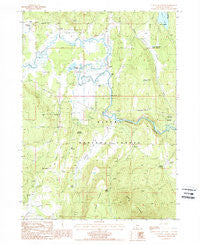
~ S Ocholis Canyon OR topo map, 1:24000 scale, 7.5 X 7.5 Minute, Historical, 1988, updated 1988
S Ocholis Canyon, Oregon, USGS topographic map dated 1988.
Includes geographic coordinates (latitude and longitude). This topographic map is suitable for hiking, camping, and exploring, or framing it as a wall map.
Printed on-demand using high resolution imagery, on heavy weight and acid free paper, or alternatively on a variety of synthetic materials.
Topos available on paper, Waterproof, Poly, or Tyvek. Usually shipping rolled, unless combined with other folded maps in one order.
- Product Number: USGS-5421760
- Free digital map download (high-resolution, GeoPDF): S Ocholis Canyon, Oregon (file size: 13 MB)
- Map Size: please refer to the dimensions of the GeoPDF map above
- Weight (paper map): ca. 55 grams
- Map Type: POD USGS Topographic Map
- Map Series: HTMC
- Map Verison: Historical
- Cell ID: 39087
- Scan ID: 281346
- Imprint Year: 1988
- Woodland Tint: Yes
- Aerial Photo Year: 1983
- Edit Year: 1988
- Field Check Year: 1984
- Datum: NAD27
- Map Projection: Lambert Conformal Conic
- Provisional map: Yes
- Map published by United States Geological Survey
- Map Language: English
- Scanner Resolution: 600 dpi
- Map Cell Name: S'Ocholis Canyon
- Grid size: 7.5 X 7.5 Minute
- Date on map: 1988
- Map Scale: 1:24000
- Geographical region: Oregon, United States
Neighboring Maps:
All neighboring USGS topo maps are available for sale online at a variety of scales.
Spatial coverage:
Topo map S Ocholis Canyon, Oregon, covers the geographical area associated the following places:
- Whitehorse Spring - Chiloquin Agency Lake Fire District Station 3 - Saddle Mountain Spring - Kamkaun Spring - Flat Lake - Mahogany Ridge Reservoir - McReady Spring - Lone Pine Reservoir - Four Point Spring - Dockney Flat - S'Ocholis Canyon - No Name Flat - Borrow Reservoir - Hawks Lake - Wolff Ranch - Cedar Spring - Corbell Ditch - Long Prairie Reservoir - Saddle Mountain - Lone Pine Quarry - Wrights Meadows - Quarry Reservoir - McCready Ranch - S'Ocholis Campground (historical) - Harris Reservoir - Long Prairie - Nut Reservoir
- Map Area ID: AREA42.62542.5-121.75-121.625
- Northwest corner Lat/Long code: USGSNW42.625-121.75
- Northeast corner Lat/Long code: USGSNE42.625-121.625
- Southwest corner Lat/Long code: USGSSW42.5-121.75
- Southeast corner Lat/Long code: USGSSE42.5-121.625
- Northern map edge Latitude: 42.625
- Southern map edge Latitude: 42.5
- Western map edge Longitude: -121.75
- Eastern map edge Longitude: -121.625


