
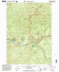
~ Illahee Rock OR topo map, 1:24000 scale, 7.5 X 7.5 Minute, Historical, 1997, updated 1999
Illahee Rock, Oregon, USGS topographic map dated 1997.
Includes geographic coordinates (latitude and longitude). This topographic map is suitable for hiking, camping, and exploring, or framing it as a wall map.
Printed on-demand using high resolution imagery, on heavy weight and acid free paper, or alternatively on a variety of synthetic materials.
Topos available on paper, Waterproof, Poly, or Tyvek. Usually shipping rolled, unless combined with other folded maps in one order.
- Product Number: USGS-5419182
- Free digital map download (high-resolution, GeoPDF): Illahee Rock, Oregon (file size: 18 MB)
- Map Size: please refer to the dimensions of the GeoPDF map above
- Weight (paper map): ca. 55 grams
- Map Type: POD USGS Topographic Map
- Map Series: HTMC
- Map Verison: Historical
- Cell ID: 72405
- Scan ID: 280279
- Imprint Year: 1999
- Woodland Tint: Yes
- Aerial Photo Year: 1997
- Datum: NAD27
- Map Projection: Lambert Conformal Conic
- Map published by United States Geological Survey
- Map published by United States Forest Service
- Map Language: English
- Scanner Resolution: 600 dpi
- Map Cell Name: Illahee Rock
- Grid size: 7.5 X 7.5 Minute
- Date on map: 1997
- Map Scale: 1:24000
- Geographical region: Oregon, United States
Neighboring Maps:
All neighboring USGS topo maps are available for sale online at a variety of scales.
Spatial coverage:
Topo map Illahee Rock, Oregon, covers the geographical area associated the following places:
- Rattlesnake Creek - Horse Prairie - Dry Creek Cabin - Bradley Ridge - Collins Camp - Dry Creek - Dry Gulch Creek - Spring Mountain Way - Ragged Butte - Illahee Spring - Eagle Rock Recreation Site - Illahee Guard Station - Spring Mountain - Wild Rose Camp - Pine Bench - Eagle Creek - Oak Flat Lookout - Dark Canyon - Marsters Bridge - Hole in the Ground - Deception Way - North Umpqua Division - Pine Point - Weeping Rock Campground - Devils Stairway - Illahee Flats - Deception Creek - Happy Creek - Oak Flats - Little Oak Flat - Charcoal Point - Calf Creek - Harding Butte - Boulder Creek - Rattlesnake Rock - Eagle Rock - Bear Point - Panther Leap - Weeping Rock Campground Boat Launch - Copeland Creek - Wild Rose Point - Illahee Rock - Rattlesnake Ridge - Soda Springs Power Plant - Snuff Shelter - Bartrums Rock - Quartz Point - Boulder Flat Recreation Site - Eagle Ridge - Old Man Rock - Wilson Creek - Onion Creek
- Map Area ID: AREA43.37543.25-122.625-122.5
- Northwest corner Lat/Long code: USGSNW43.375-122.625
- Northeast corner Lat/Long code: USGSNE43.375-122.5
- Southwest corner Lat/Long code: USGSSW43.25-122.625
- Southeast corner Lat/Long code: USGSSE43.25-122.5
- Northern map edge Latitude: 43.375
- Southern map edge Latitude: 43.25
- Western map edge Longitude: -122.625
- Eastern map edge Longitude: -122.5


