
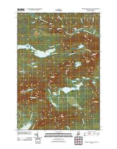
~ Barren Mountain East ME topo map, 1:24000 scale, 7.5 X 7.5 Minute, Historical, 2011
Barren Mountain East, Maine, USGS topographic map dated 2011.
Includes geographic coordinates (latitude and longitude). This topographic map is suitable for hiking, camping, and exploring, or framing it as a wall map.
Printed on-demand using high resolution imagery, on heavy weight and acid free paper, or alternatively on a variety of synthetic materials.
Topos available on paper, Waterproof, Poly, or Tyvek. Usually shipping rolled, unless combined with other folded maps in one order.
- Product Number: USGS-5411698
- Free digital map download (high-resolution, GeoPDF): Barren Mountain East, Maine (file size: 31 MB)
- Map Size: please refer to the dimensions of the GeoPDF map above
- Weight (paper map): ca. 55 grams
- Map Type: POD USGS Topographic Map
- Map Series: US Topo
- Map Verison: Historical
- Cell ID: 69267
- Datum: North American Datum of 1983
- Map Projection: Transverse Mercator
- Map Cell Name: Barren Mountain East
- Grid size: 7.5 X 7.5 Minute
- Date on map: 2011
- Map Scale: 1:24000
- Geographical region: Maine, United States
Neighboring Maps:
All neighboring USGS topo maps are available for sale online at a variety of scales.
Spatial coverage:
Topo map Barren Mountain East, Maine, covers the geographical area associated the following places:
- Fourth Mountain - West Chairback Pond - Duck Cove - Big Wilder Pond - Boot Pond - Little Wilder Pond - The Hermitage Preserve - Gulf Hagas Trail - Indian Pond - Mud Pond - Dam Pond - Third Mountain - Hay Brook - Lost Pond - Buttermilk Falls - The Jaws - Chairback Mountain - South Pond - Rays Mill Pond - Camp Pond - First Narrows - Bear Brook - Cloud Pond - Stair Falls - Henderson Brook - Columbus Mountain - Lucia Pond - The Notch - Cloud Pond Brook - Lower Deadwater - The Hermitage - Billings Falls - Caribou Bog - East Chairback Pond - Benson Mountain - Sampson Pond - Second Narrows - Hammond Street Pitch - Screw Auger Falls - Hays Brook Falls - Gulf Hagas Brook - Beaver Pond - Barren Mountain - Barren Mountain Lookout Tower - T7 R9 NWP - Pugwash Pond - Roaring Brook Mountain
- Map Area ID: AREA45.545.375-69.375-69.25
- Northwest corner Lat/Long code: USGSNW45.5-69.375
- Northeast corner Lat/Long code: USGSNE45.5-69.25
- Southwest corner Lat/Long code: USGSSW45.375-69.375
- Southeast corner Lat/Long code: USGSSE45.375-69.25
- Northern map edge Latitude: 45.5
- Southern map edge Latitude: 45.375
- Western map edge Longitude: -69.375
- Eastern map edge Longitude: -69.25


