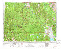
~ Kalispell MT topo map, 1:250000 scale, 1 X 2 Degree, Historical, 1957, updated 1967
Kalispell, Montana, USGS topographic map dated 1957.
Includes geographic coordinates (latitude and longitude). This topographic map is suitable for hiking, camping, and exploring, or framing it as a wall map.
Printed on-demand using high resolution imagery, on heavy weight and acid free paper, or alternatively on a variety of synthetic materials.
Topos available on paper, Waterproof, Poly, or Tyvek. Usually shipping rolled, unless combined with other folded maps in one order.
- Product Number: USGS-5402026
- Free digital map download (high-resolution, GeoPDF): Kalispell, Montana (file size: 24 MB)
- Map Size: please refer to the dimensions of the GeoPDF map above
- Weight (paper map): ca. 55 grams
- Map Type: POD USGS Topographic Map
- Map Series: HTMC
- Map Verison: Historical
- Cell ID: 68850
- Scan ID: 268769
- Imprint Year: 1967
- Woodland Tint: Yes
- Edit Year: 1966
- Field Check Year: 1957
- Datum: Unstated
- Map Projection: Transverse Mercator
- Map published by United States Geological Survey
- Map Language: English
- Scanner Resolution: 600 dpi
- Map Cell Name: Kalispell
- Grid size: 1 X 2 Degree
- Date on map: 1957
- Map Scale: 1:250000
- Geographical region: Montana, United States
Neighboring Maps:
All neighboring USGS topo maps are available for sale online at a variety of scales.
Spatial coverage:
Topo map Kalispell, Montana, covers the geographical area associated the following places:
- Vista - Northridge Heights - Twin Acres Mobile Home Park - Foster Mobile Home Park - Mills Springs (historical) - Jennings - Heron - Radnor - Idlewise Court - Roosville - Holt - Big Mountain Trailer Park - Green Acres - Ramsey (historical) - Stipes Trailer Court - Manicke (historical) - Orchard Hills Mobile Home Park - Somers - La Salle - Stonehill (historical) - Ashley (historical) - Outback Mobile Home Settlement - East Evergreen Mobile Home Park - Tobacco (historical) - Hungry Horse - Bellevue Manor Trailer Park - Duncan (historical) - Willow Creek Mobile Home Park - Mar-Le Villa - Rose Crossing - Pioneer Junction - Swan River - Big Sky Colonial Manor - Meadow Manor Incorporated - Trailcreek - Yaak - Negro Prairie (historical) - Rhodes - Ferndale Mobile Court - Jessup - Mountain View Mobile Home Park - Alpine Mobile Manor - White Haven - Polebridge - Kalispell - Martin City - Rivers Edge Mobile Home Park - Ripley - Mountain View Mobile Home Park - Wurtz Hill - Happy Haven - Ridgewood Terrace - Ford - Shady Lane Mobile Home Park - Dodge Summit - Parkdale (historical) - Troy - Eagle Lake Ranch - Woods Bay - South Fork (historical) - Lupfer - Whitefish - Reuter (historical) - Kootenai Falls - Forest Acres Mobile Home Park - Rexford - Kens Trailer Court - Ant Flat - Posts Trailer Court - Fish Lake (historical) - Libby - Bigfork - Wagsmith Villa (historical) - Batavia - Yakt (historical) - Ferndale - Coram - Yakt - Sylvanite - Smead (historical) - Scotchville (historical) - Swan River (historical) - Riverside (historical) - Trego - Tobacco - Olney - Fortine - Happys Inn - Ural (historical) - Pine Park - Halfmoon - Country Estates Mobile Home Park - Forest Hill Village - Volcour (historical) - Marion - Meadowlark Mobile Home Park - Brenchley Mobile Home Park - Gateway (historical) - Creston - Lazy Day Court
- Map Area ID: AREA4948-116-114
- Northwest corner Lat/Long code: USGSNW49-116
- Northeast corner Lat/Long code: USGSNE49-114
- Southwest corner Lat/Long code: USGSSW48-116
- Southeast corner Lat/Long code: USGSSE48-114
- Northern map edge Latitude: 49
- Southern map edge Latitude: 48
- Western map edge Longitude: -116
- Eastern map edge Longitude: -114

