
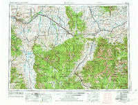
~ Bozeman MT topo map, 1:250000 scale, 1 X 2 Degree, Historical, 1958, updated 1974
Bozeman, Montana, USGS topographic map dated 1958.
Includes geographic coordinates (latitude and longitude). This topographic map is suitable for hiking, camping, and exploring, or framing it as a wall map.
Printed on-demand using high resolution imagery, on heavy weight and acid free paper, or alternatively on a variety of synthetic materials.
Topos available on paper, Waterproof, Poly, or Tyvek. Usually shipping rolled, unless combined with other folded maps in one order.
- Product Number: USGS-5401912
- Free digital map download (high-resolution, GeoPDF): Bozeman, Montana (file size: 26 MB)
- Map Size: please refer to the dimensions of the GeoPDF map above
- Weight (paper map): ca. 55 grams
- Map Type: POD USGS Topographic Map
- Map Series: HTMC
- Map Verison: Historical
- Cell ID: 75024
- Scan ID: 268672
- Imprint Year: 1974
- Woodland Tint: Yes
- Visual Version Number: 2
- Aerial Photo Year: 1972
- Edit Year: 1972
- Field Check Year: 1958
- Datum: Unstated
- Map Projection: Transverse Mercator
- Map published by United States Geological Survey
- Map published by: Military, Other
- Map Language: English
- Scanner Resolution: 600 dpi
- Map Cell Name: Bozeman
- Grid size: 1 X 2 Degree
- Date on map: 1958
- Map Scale: 1:250000
- Geographical region: Montana, United States
Neighboring Maps:
All neighboring USGS topo maps are available for sale online at a variety of scales.
Spatial coverage:
Topo map Bozeman, Montana, covers the geographical area associated the following places:
- Cardwell - Shaws - Minnesota Addition - Dogtown (historical) - Cowan - Adobe (historical) - West College Park - Harrison - Haley Subdivision Trailer Court - Eau Clair (historical) - Chico - Star Addition - Bueno Vista Acres Trailer Court - Muir - Rocky Creek Trailer Court - Chadborn - Wilsall - Big Sky Canyon Village - Riverside Addition - Sterling - Edilou - Bisel - Gilroy - Red Bluff - Merriman - Kerns - Lazy Day (historical) - Four Corners - Huletts Trailer Court - Sunset Trailer Court - Little Bear (historical) - Faith Mobile Home Court - Murphys Trailer Court - Elton - Bozeman - Golden Age Village Trailer Park - Dailey (historical) - Sedan - Brisbin - Lexley Acres Mobile Home Park - George Norman Trailer Court - Trident - Urback Place - Manhattan - Gallatin Gateway - Abe (historical) - Miner - Wagon Wheel Trailer Court - Montanapolis Springs (historical) - Shields - Aldridge - Gallatin (historical) - Jeffers - Junction - Hunters Hot Springs - Storrs (historical) - Hillman - Tee Pee Trailer Court - Patterson - Clyde Park - Woods Place - Gallop (historical) - Hiland Trailer Court - Busch - Atkins - Summit - Balmont - Thomasville (historical) - Varney - Glastonbury - Chimney Rock - Springhill - Camona - Monforton (historical) - Upper Bridger (historical) - Reasville (historical) - Eldridge (historical) - Emigrant - Beals - Stumps Subdivision - Chico Hot Springs - Menard - Reese Creek (historical) - Anceney - Cameron - Nelsons Trailer Court - McLeod - Calamity Janes Trailer Court - Forest Park Mobile Home and RV Park - Vincent - Cowboys Heaven - Wisner Crossing - Livingston - Ennis - Accola - Amsterdam - Central City (historical) - Reed Trailer Court - Hidden Valley Mobile Estates - Eustis
- Map Area ID: AREA4645-112-110
- Northwest corner Lat/Long code: USGSNW46-112
- Northeast corner Lat/Long code: USGSNE46-110
- Southwest corner Lat/Long code: USGSSW45-112
- Southeast corner Lat/Long code: USGSSE45-110
- Northern map edge Latitude: 46
- Southern map edge Latitude: 45
- Western map edge Longitude: -112
- Eastern map edge Longitude: -110


