
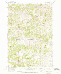
~ Threemile Buttes MT topo map, 1:24000 scale, 7.5 X 7.5 Minute, Historical, 1966, updated 1969
Threemile Buttes, Montana, USGS topographic map dated 1966.
Includes geographic coordinates (latitude and longitude). This topographic map is suitable for hiking, camping, and exploring, or framing it as a wall map.
Printed on-demand using high resolution imagery, on heavy weight and acid free paper, or alternatively on a variety of synthetic materials.
Topos available on paper, Waterproof, Poly, or Tyvek. Usually shipping rolled, unless combined with other folded maps in one order.
- Product Number: USGS-5399618
- Free digital map download (high-resolution, GeoPDF): Threemile Buttes, Montana (file size: 14 MB)
- Map Size: please refer to the dimensions of the GeoPDF map above
- Weight (paper map): ca. 55 grams
- Map Type: POD USGS Topographic Map
- Map Series: HTMC
- Map Verison: Historical
- Cell ID: 45031
- Scan ID: 267188
- Imprint Year: 1969
- Woodland Tint: Yes
- Aerial Photo Year: 1962
- Field Check Year: 1966
- Datum: NAD27
- Map Projection: Polyconic
- Map published by United States Geological Survey
- Map Language: English
- Scanner Resolution: 600 dpi
- Map Cell Name: Threemile Buttes
- Grid size: 7.5 X 7.5 Minute
- Date on map: 1966
- Map Scale: 1:24000
- Geographical region: Montana, United States
Neighboring Maps:
All neighboring USGS topo maps are available for sale online at a variety of scales.
Spatial coverage:
Topo map Threemile Buttes, Montana, covers the geographical area associated the following places:
- Ridenour Reservoir - Upper Fifteenmile Spring - McLennon Spring Number Two - Ole Spring - Collinge Spring - Otter Division - Dalzells Spring - Threemile Buttes - Old Faithful Spring - Skinner Gulch Spring Number Two - Watt Spring - Tenmile Well - Mankameyer Spring - Tenmile Spring - Blue Bore Spring - Dead Horse Spring - Doonan Spring - Sawmill Spring - Knudson Spring - Butte Spring - Potter Spring - Quebbeman Spring - Montgomery Spring - Abbott Spring - Anchor Spring - Roundup Creek - Skinner Gulch Spring Number One - Watt Draw Spring Number One - Joe Yager Spring - Bowers Reservoir - Script Spring - Bottles School (historical) - Watt Draw - 04S47E12CABD01 Well - Joe Spring - McLennon Spring Number One - Sterling Mine - Spring Creek - Spring Creek Spring - Wild Hog Spring - 05S47E10BCAB01 Well - Knudson Spring Number Two - 05S47E19BCBA01 Well - Phillips Well - Middle Creek Spring
- Map Area ID: AREA45.545.375-106-105.875
- Northwest corner Lat/Long code: USGSNW45.5-106
- Northeast corner Lat/Long code: USGSNE45.5-105.875
- Southwest corner Lat/Long code: USGSSW45.375-106
- Southeast corner Lat/Long code: USGSSE45.375-105.875
- Northern map edge Latitude: 45.5
- Southern map edge Latitude: 45.375
- Western map edge Longitude: -106
- Eastern map edge Longitude: -105.875


