
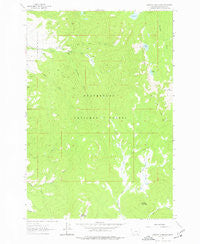
~ Stewart Mountain MT topo map, 1:24000 scale, 7.5 X 7.5 Minute, Historical, 1962, updated 1977
Stewart Mountain, Montana, USGS topographic map dated 1962.
Includes geographic coordinates (latitude and longitude). This topographic map is suitable for hiking, camping, and exploring, or framing it as a wall map.
Printed on-demand using high resolution imagery, on heavy weight and acid free paper, or alternatively on a variety of synthetic materials.
Topos available on paper, Waterproof, Poly, or Tyvek. Usually shipping rolled, unless combined with other folded maps in one order.
- Product Number: USGS-5399204
- Free digital map download (high-resolution, GeoPDF): Stewart Mountain, Montana (file size: 9 MB)
- Map Size: please refer to the dimensions of the GeoPDF map above
- Weight (paper map): ca. 55 grams
- Map Type: POD USGS Topographic Map
- Map Series: HTMC
- Map Verison: Historical
- Cell ID: 43180
- Scan ID: 266954
- Imprint Year: 1977
- Woodland Tint: Yes
- Aerial Photo Year: 1955
- Field Check Year: 1962
- Datum: NAD27
- Map Projection: Polyconic
- Map published by United States Geological Survey
- Map Language: English
- Scanner Resolution: 600 dpi
- Map Cell Name: Stewart Mountain
- Grid size: 7.5 X 7.5 Minute
- Date on map: 1962
- Map Scale: 1:24000
- Geographical region: Montana, United States
Neighboring Maps:
All neighboring USGS topo maps are available for sale online at a variety of scales.
Spatial coverage:
Topo map Stewart Mountain, Montana, covers the geographical area associated the following places:
- Steel Creek Campground - Baldy Lake - Martin Mine - Steel Creek Ranger Station - East Fork Warm Springs Creek - Stewart Mountain - Lily Lake - Stewart Lake - Franklin Number 1 Mine - Martin Mine - South Fork Steel Creek - Arnold Mine - Wisconsin Creek - Maynard Mine - Maynard Mine - Sand Lake - Triangle Park - West Fork Warm Springs Creek - Arnold Mine - Stewart Meadows - Shelly Mine - Bear Mine - 03S14W04CACA01 Well - Camp Mountain - Odell Mountain - Last Chance - Sugar Load Mine - Moose Meadows - Elbow Lake - North Fork Sheep Creek - Bonanza (historical) - Coeur D'Alene Mine
- Map Area ID: AREA45.62545.5-113.375-113.25
- Northwest corner Lat/Long code: USGSNW45.625-113.375
- Northeast corner Lat/Long code: USGSNE45.625-113.25
- Southwest corner Lat/Long code: USGSSW45.5-113.375
- Southeast corner Lat/Long code: USGSSE45.5-113.25
- Northern map edge Latitude: 45.625
- Southern map edge Latitude: 45.5
- Western map edge Longitude: -113.375
- Eastern map edge Longitude: -113.25


