
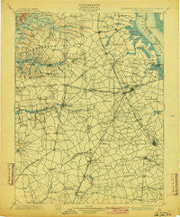
~ Dover DE topo map, 1:125000 scale, 30 X 30 Minute, Historical, 1899, updated 1904
Dover, Delaware, USGS topographic map dated 1899.
Includes geographic coordinates (latitude and longitude). This topographic map is suitable for hiking, camping, and exploring, or framing it as a wall map.
Printed on-demand using high resolution imagery, on heavy weight and acid free paper, or alternatively on a variety of synthetic materials.
Topos available on paper, Waterproof, Poly, or Tyvek. Usually shipping rolled, unless combined with other folded maps in one order.
- Product Number: USGS-5390386
- Free digital map download (high-resolution, GeoPDF): Dover, Delaware (file size: 9 MB)
- Map Size: please refer to the dimensions of the GeoPDF map above
- Weight (paper map): ca. 55 grams
- Map Type: POD USGS Topographic Map
- Map Series: HTMC
- Map Verison: Historical
- Cell ID: 65368
- Scan ID: 255748
- Imprint Year: 1904
- Survey Year: 1896
- Datum: Unstated
- Map Projection: Unstated
- Map published by United States Geological Survey
- Map Language: English
- Scanner Resolution: 600 dpi
- Map Cell Name: Dover
- Grid size: 30 X 30 Minute
- Date on map: 1899
- Map Scale: 1:125000
- Geographical region: Delaware, United States
Neighboring Maps:
All neighboring USGS topo maps are available for sale online at a variety of scales.
Spatial coverage:
Topo map Dover, Delaware, covers the geographical area associated the following places:
- Earleville - Granada Mobile Home Park - Bush Manor - Plymouth - Moores Lake Development - Schoolview - Star Hill - Felton Heights - Cecilton - Northridge - Woodstock Court - Hidden Pond - Sunnyside Village - Two Rivers - Whispering Pines Mobile Home Park - Hourglass - Viola - Hammville - Spry Landing - Meadow Ridge - Warrens Mobile Home Park - Knocks Folly - Dupont Manor - Strimels Mobile Home Park - Star Hill Village - Fords Corner - Carter Development - Bay View Estates - Garrison Lake Green - Shady Lane - Massey - Thomas Landing - Lincoln Park - Pine Cove - Melbourne Manor - Cedarbrook Acres - Forest Landing - Spruance City - Gander Hill - Rolling Meadows - Galena - Oxyoke Mobile Home Park - The Village at Wild Quail - Wheatleys Pond - Huntley Circle - Fredrick Lodge Mobile Home Park - Highland Acres - The Village at Church Hill Crossing - Beachwood Glen - Eagles Nest - Berrytown - The Meadows - Clayton - Unicorn Manor - Goldsboro - Pennwood - Sycamore Farms - Lambson - Mallard Pond - Indian Acres - Chesterville Forest - Swanton (historical) - Great Oak Farms - Pearsons Corner - Casson Corner - Brookfield - Moores Corner - Rockland West - Mahan - Double Creek Wood - Pine Tree Corners - Mussel Shoals - Oak Forest Estates - Barclay Farms - Coopers Corner - Village of Westover - Templeville - Wooden Bridge - Shorewood - Felton - McGinnes - Ridgewood Manor - Piney Ridge - Lebanon - Chapeltown - Cleaves Fork - Cronshaw - Unicorn Crossing - Slaughter - Evergreen Acres - Zurkow Development - Woodside - Kennedyville - Sheriden - Mayfair - Cash Corner (historical) - Woodfield - Melville Crossroads - Crossgates - Stevens Corner
- Map Area ID: AREA39.539-76-75.5
- Northwest corner Lat/Long code: USGSNW39.5-76
- Northeast corner Lat/Long code: USGSNE39.5-75.5
- Southwest corner Lat/Long code: USGSSW39-76
- Southeast corner Lat/Long code: USGSSE39-75.5
- Northern map edge Latitude: 39.5
- Southern map edge Latitude: 39
- Western map edge Longitude: -76
- Eastern map edge Longitude: -75.5


