
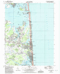
~ Bethany Beach DE topo map, 1:24000 scale, 7.5 X 7.5 Minute, Historical, 1984, updated 1992
Bethany Beach, Delaware, USGS topographic map dated 1984.
Includes geographic coordinates (latitude and longitude). This topographic map is suitable for hiking, camping, and exploring, or framing it as a wall map.
Printed on-demand using high resolution imagery, on heavy weight and acid free paper, or alternatively on a variety of synthetic materials.
Topos available on paper, Waterproof, Poly, or Tyvek. Usually shipping rolled, unless combined with other folded maps in one order.
- Product Number: USGS-5389900
- Free digital map download (high-resolution, GeoPDF): Bethany Beach, Delaware (file size: 15 MB)
- Map Size: please refer to the dimensions of the GeoPDF map above
- Weight (paper map): ca. 55 grams
- Map Type: POD USGS Topographic Map
- Map Series: HTMC
- Map Verison: Historical
- Cell ID: 3526
- Scan ID: 255486
- Imprint Year: 1992
- Woodland Tint: Yes
- Photo Revision Year: 1991
- Aerial Photo Year: 1989
- Edit Year: 1991
- Field Check Year: 1982
- Datum: NAD83
- Map Projection: Universal Transverse Mercator
- Map published by United States Geological Survey
- Map Language: English
- Scanner Resolution: 600 dpi
- Map Cell Name: Bethany Beach
- Grid size: 7.5 X 7.5 Minute
- Date on map: 1984
- Map Scale: 1:24000
- Geographical region: Delaware, United States
Neighboring Maps:
All neighboring USGS topo maps are available for sale online at a variety of scales.
Spatial coverage:
Topo map Bethany Beach, Delaware, covers the geographical area associated the following places:
- Pond Acres - Meyle Estates - Wilgus Subdivision - Quillens Point - Bank Harbor Retreat - Banks Acres - Banks Harbor Estates - Denton Woods Mobile Home Park - Murry Landing - Foxfire Meadow - Rogers Haven - Mill Run Acres - Rogers Haven - Bay Shore Mobile Home Park - Bethany Village - Cedar Shores - Indian Harbor Villa - Denton Mills - Miller Creek Park Mobile Home Park - Banksville Park - Murrays Haven - Country Estates - Banks Development - Sea Colony - Fox Run Mobile Home Park - Newtons Acres - York Beach - Tower Shores - Ocean Way Estates - Tuckahoe Acres - Bethany Beach - Indian Landing Mobile Home Park - Murray Estates - Strawberry Landing - Steele Acres - Bottom Hills - Bayside Hamlet - Seabreak - Pine Grove - White Creek Manor - Denton Manor - Collins Creek Estates - Millville - Sea Del Estates - Bayberry Dunes - The Reservation - Sussex Shores - Sea Colony East - Calhoun Landing - Ocean Village - Gulls Nest - Ocean View - Middlesex Beach - Collins Park Mobile Home Park - Bethany Dunes - Bay View Park - Club House Landing - Green Briar Court - Byewood Manor - Land of Pleasant Living - Lynn Lee Village Mobile Home Park - Piney Point - Holly Ridge - Plantation Park II Mobile Home Park - Shady Dell Mobile Home Park - South Bethany - Cedarville Mobile Home Park
- Map Area ID: AREA38.62538.5-75.125-75
- Northwest corner Lat/Long code: USGSNW38.625-75.125
- Northeast corner Lat/Long code: USGSNE38.625-75
- Southwest corner Lat/Long code: USGSSW38.5-75.125
- Southeast corner Lat/Long code: USGSSE38.5-75
- Northern map edge Latitude: 38.625
- Southern map edge Latitude: 38.5
- Western map edge Longitude: -75.125
- Eastern map edge Longitude: -75


