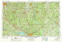
~ Spartanburg SC topo map, 1:250000 scale, 1 X 2 Degree, Historical, 1953, updated 1973
Spartanburg, South Carolina, USGS topographic map dated 1953.
Includes geographic coordinates (latitude and longitude). This topographic map is suitable for hiking, camping, and exploring, or framing it as a wall map.
Printed on-demand using high resolution imagery, on heavy weight and acid free paper, or alternatively on a variety of synthetic materials.
Topos available on paper, Waterproof, Poly, or Tyvek. Usually shipping rolled, unless combined with other folded maps in one order.
- Product Number: USGS-5389170
- Free digital map download (high-resolution, GeoPDF): Spartanburg, South Carolina (file size: 21 MB)
- Map Size: please refer to the dimensions of the GeoPDF map above
- Weight (paper map): ca. 55 grams
- Map Type: POD USGS Topographic Map
- Map Series: HTMC
- Map Verison: Historical
- Cell ID: 74963
- Scan ID: 262056
- Imprint Year: 1973
- Woodland Tint: Yes
- Photo Revision Year: 1969
- Edit Year: 1969
- Field Check Year: 1953
- Datum: Unstated
- Map Projection: Transverse Mercator
- Map published by United States Geological Survey
- Map Language: English
- Scanner Resolution: 600 dpi
- Map Cell Name: Spartanburg
- Grid size: 1 X 2 Degree
- Date on map: 1953
- Map Scale: 1:250000
- Geographical region: South Carolina, United States
Neighboring Maps:
All neighboring USGS topo maps are available for sale online at a variety of scales.
Spatial coverage:
Topo map Spartanburg, South Carolina, covers the geographical area associated the following places:
- Bonham - Briarwood - Bishop Town (historical) - Colonial Heights - Cantys Lane - Winnsboro Mills - Van Wyck - Huntcliff - Hickory Grove - Glenn Springs - Goodwins Crossroads - Herbert - Calvin (historical) - Goucher - Dutchbrook - Evinsville - Boyd - Gilliam Spring (historical) - Gregwood - Country Club Estates - Chesterfield - Flint Hill - Lazy Day Acres - Hancockville (historical) - Anvil Rock - Pomaria - Douglas - Lakeview Estates - Tradesville - Cassatt - Prestwood Village - McCutchens Crossroads - Sunset Acres - Pineglen - Belair Acres - Valley Park - Lockhart - Cool Springs - Leaphart - Stoneboro - Folkestone - Millbank (historical) - Kilbourne Park - Miller Crossing - White Rock - East Lake Hills - Woodfield Park - Rivers (historical) - Old Point Station - Wallaceville - Ebenezer - Oak Forest - Ashland - Southwood Estates - Jordan Mill - Pine Ridge - Franklin Colony - Wilkinsville - Cartersville - Southland Park - Cedar Grove - Lever (historical) - Lowmans Crossroads (historical) - Eau Claire - South Lynchburg - Millville (historical) - Jefferson - Black Jack Valley (historical) - Hartsville - Belair Estates - Challedon - Jackson - State Park - Primus - Rabon Crossroads - Ravenwood - Clinton - Wells Crossroads - Colemans Crossroads - Acapulco - Grace - Milmont Shores - Tuckertown - Middendorf - Shelton - Lynchburg - Elgin - Forest Acres - Sedgefield - McConnells - Jonesville - Spring Valley - Cedar Springs - Woodland Heights - Fosters Crossroads - Windsor Heights - Borax (historical) - Hammond - Rock Hill - Jaars
- Map Area ID: AREA3534-82-80
- Northwest corner Lat/Long code: USGSNW35-82
- Northeast corner Lat/Long code: USGSNE35-80
- Southwest corner Lat/Long code: USGSSW34-82
- Southeast corner Lat/Long code: USGSSE34-80
- Northern map edge Latitude: 35
- Southern map edge Latitude: 34
- Western map edge Longitude: -82
- Eastern map edge Longitude: -80

