
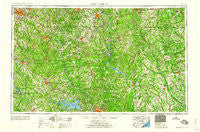
~ Spartanburg SC topo map, 1:250000 scale, 1 X 2 Degree, Historical, 1960, updated 1960
Spartanburg, South Carolina, USGS topographic map dated 1960.
Includes geographic coordinates (latitude and longitude). This topographic map is suitable for hiking, camping, and exploring, or framing it as a wall map.
Printed on-demand using high resolution imagery, on heavy weight and acid free paper, or alternatively on a variety of synthetic materials.
Topos available on paper, Waterproof, Poly, or Tyvek. Usually shipping rolled, unless combined with other folded maps in one order.
- Product Number: USGS-5389164
- Free digital map download (high-resolution, GeoPDF): Spartanburg, South Carolina (file size: 23 MB)
- Map Size: please refer to the dimensions of the GeoPDF map above
- Weight (paper map): ca. 55 grams
- Map Type: POD USGS Topographic Map
- Map Series: HTMC
- Map Verison: Historical
- Cell ID: 74963
- Scan ID: 262053
- Imprint Year: 1960
- Woodland Tint: Yes
- Field Check Year: 1953
- Datum: Unstated
- Map Projection: Transverse Mercator
- Map published by United States Geological Survey
- Map published by United States Army Corps of Engineers
- Map published by United States Army
- Map Language: English
- Scanner Resolution: 600 dpi
- Map Cell Name: Spartanburg
- Grid size: 1 X 2 Degree
- Date on map: 1960
- Map Scale: 1:250000
- Geographical region: South Carolina, United States
Neighboring Maps:
All neighboring USGS topo maps are available for sale online at a variety of scales.
Spatial coverage:
Topo map Spartanburg, South Carolina, covers the geographical area associated the following places:
- Fairwold - Evergreen Park - Shiland Hills - Brockington Heights - Smyrna - Boland Crossroads (historical) - Selwood Shores - Sherwood Acres - Lydia - Parr - Meador (historical) - Binghamtown (historical) - Forest Hills - Cross Hill - Farmfields - Rock Creek - Mudlick - Bailey Town (historical) - Anglewood - West Springs - Highland Farms - Shepard - Saluda - Dalzell - Lowmans Crossroads (historical) - Jeffers Place - Latimer Manor - Spring Grove (historical) - Beckhamville - Rock Hill - Pine Valley - White Rock - Spring Hill - Briarwood - Wadsworth - Mandel Park - Meadow Lakes - Windhams Crossroads - Dudley - Fork Hill Crossroads - Mechanicsville - Trexler Acres - Lakeview Acres - Leesburg - DuBose Crossroads - Robinwood Estates - Smallwood - Kennedy Mill - Keswick - Dutchbrook - Middendorf - Richland - Cross Anchor - Lake Village - Meansville (historical) - Hilltop - Houston - Manville - Ben Avon - McCrearys Quarter (historical) - Walden - Broad River Estates - Ravinwood - Ogden - West Chester - Ellerbee (historical) - Oakdale Acres - Segars - Kelton - Catchall - Sumei Circle - Old Buckhead - Riverview Terrace - Bonnie Forest - Foxhall - Beaver Creek - Allen Acres - Rock Branch North - Northwood - Sapps Crossroads - Georgia Estates - Saint Andrews - Mineral Springs - Caskey - Woodland Heights - Wooded Valley - McCutchen (historical) - Red Hill - Bishop Town (historical) - Robat - Nauvassee (historical) - Pineglen - Kelly - Belleview - Springwood Lakes - Hagood - Riverbanks - Hyatts - Great Falls - Big Springs
- Map Area ID: AREA3534-82-80
- Northwest corner Lat/Long code: USGSNW35-82
- Northeast corner Lat/Long code: USGSNE35-80
- Southwest corner Lat/Long code: USGSSW34-82
- Southeast corner Lat/Long code: USGSSE34-80
- Northern map edge Latitude: 35
- Southern map edge Latitude: 34
- Western map edge Longitude: -82
- Eastern map edge Longitude: -80


