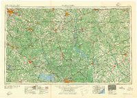
~ Spartanburg SC topo map, 1:250000 scale, 1 X 2 Degree, Historical, 1941
Spartanburg, South Carolina, USGS topographic map dated 1941.
Includes geographic coordinates (latitude and longitude). This topographic map is suitable for hiking, camping, and exploring, or framing it as a wall map.
Printed on-demand using high resolution imagery, on heavy weight and acid free paper, or alternatively on a variety of synthetic materials.
Topos available on paper, Waterproof, Poly, or Tyvek. Usually shipping rolled, unless combined with other folded maps in one order.
- Product Number: USGS-5389162
- Free digital map download (high-resolution, GeoPDF): Spartanburg, South Carolina (file size: 28 MB)
- Map Size: please refer to the dimensions of the GeoPDF map above
- Weight (paper map): ca. 55 grams
- Map Type: POD USGS Topographic Map
- Map Series: HTMC
- Map Verison: Historical
- Cell ID: 74963
- Scan ID: 262052
- Woodland Tint: Yes
- Field Check Year: 1953
- Datum: Unstated
- Map Projection: Transverse Mercator
- Map published by United States Geological Survey
- Map published by United States Army Corps of Engineers
- Map published by United States Army
- Map Language: English
- Scanner Resolution: 600 dpi
- Map Cell Name: Spartanburg
- Grid size: 1 X 2 Degree
- Date on map: 1941
- Map Scale: 1:250000
- Geographical region: South Carolina, United States
Neighboring Maps:
All neighboring USGS topo maps are available for sale online at a variety of scales.
Spatial coverage:
Topo map Spartanburg, South Carolina, covers the geographical area associated the following places:
- Scurry - Dentsville - Flat Rock - Una - Pomaria - Nitrolee - White Plains Crossroad - Ada (historical) - Erwinwood Acres - Selwood Trace - Wedgewood - Robinwood Estates - York - Blackstock - Angelus - Park Place - Bladen - Cross Roads - Herbert - Ebenezer - Ridge Road Crossroads - Smallwood - Ballentine Landing - Taxahaw - Timber Lake - Glendale - Avondale Terrace - Clarkson (historical) - Bentway Park - Mudlick - Forest Trace - Snug Harbor - Spring Lake - Waverly - Huntington (historical) - Glenwood Acres - Cason Old Field - Leeds - Wintercrest - Paris (historical) - Shady Acres - Rock Hill - Gaillard Crossroads - Black Gate - Ponderosa Gardens - Celestia (historical) - Melrose Heights - The Forest - Roddey - Pine Valley - Brookhaven - Moore - Lockhart Oil Field - Eulala - Rich Hill Crossroads - Wildcat (historical) - North Washington Park - Erwin Park - Pineglen - Elmwood - Shadow Brook - Andrews Farms - Fairfield Arms - Westerwood Acres - Evergreen Acres - Town and Country - Parr - Vaughans Crossroads - Sharon - Belleview - Longtown - Rollingwood - Irwin - Blairsville - Hancock - Hillcrest - Vanderbilt Hills - Sapps Crossroads - Humphriesville (historical) - Pinckney - Selwood Shores - Sundance - Philson Crossroads - Cromer Crossroads - Benton Heights - Laney Terrace - Fosters Crossroads - Quail Haven - Macedonia - Saxton Homes - Leesburg - Sturdivants Crossroads - Ora - Pine Village - Adamsburg - Hallmark Shores - Dawkins - Delphia - Reuben (historical) - East Lake Hills
- Map Area ID: AREA3534-82-80
- Northwest corner Lat/Long code: USGSNW35-82
- Northeast corner Lat/Long code: USGSNE35-80
- Southwest corner Lat/Long code: USGSSW34-82
- Southeast corner Lat/Long code: USGSSE34-80
- Northern map edge Latitude: 35
- Southern map edge Latitude: 34
- Western map edge Longitude: -82
- Eastern map edge Longitude: -80

