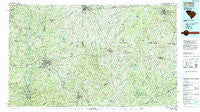
~ Lancaster SC topo map, 1:100000 scale, 30 X 60 Minute, Historical, 1986, updated 1991
Lancaster, South Carolina, USGS topographic map dated 1986.
Includes geographic coordinates (latitude and longitude). This topographic map is suitable for hiking, camping, and exploring, or framing it as a wall map.
Printed on-demand using high resolution imagery, on heavy weight and acid free paper, or alternatively on a variety of synthetic materials.
Topos available on paper, Waterproof, Poly, or Tyvek. Usually shipping rolled, unless combined with other folded maps in one order.
- Product Number: USGS-5389078
- Free digital map download (high-resolution, GeoPDF): Lancaster, South Carolina (file size: 33 MB)
- Map Size: please refer to the dimensions of the GeoPDF map above
- Weight (paper map): ca. 55 grams
- Map Type: POD USGS Topographic Map
- Map Series: HTMC
- Map Verison: Historical
- Cell ID: 67812
- Scan ID: 262009
- Imprint Year: 1991
- Woodland Tint: Yes
- Aerial Photo Year: 1984
- Edit Year: 1986
- Datum: NAD27
- Map Projection: Universal Transverse Mercator
- Map published by United States Geological Survey
- Map Language: English
- Scanner Resolution: 600 dpi
- Map Cell Name: Lancaster
- Grid size: 30 X 60 Minute
- Date on map: 1986
- Map Scale: 1:100000
- Geographical region: South Carolina, United States
Neighboring Maps:
All neighboring USGS topo maps are available for sale online at a variety of scales.
Spatial coverage:
Topo map Lancaster, South Carolina, covers the geographical area associated the following places:
- Walkersville (historical) - Harmony - Bay Springs - Quail Haven - Morven - Stoneboro - Baker Place - Gregwood - Shiloh - Sunrise Acres - Grace - Woodvale - Sutton Park - White Oaks - Poplar Hill (historical) - White Plains - Elgin Woods - Cason Old Field - Wingate - Catawba - Dwight Crossroads - Stewart Park - Evergreen Acres - Irwin - Chesterfield - Van Wyck - Green Peach Orchard - Camp Creek - Park Place - Springs Park - Minton Mill - Rossville - Curetons (historical) - Long Pine - Yorkdale - Shiloh - Westwood - Jones Crossroads - Springdale Acres - Cedar Terrace - Carmel Village - Friendship - Wade Mills - Rich Hill Crossroads - Southwood Estates - Wolf Pond Cross Roads - Russellville - Brookhaven - Roughedge - Hunts Mill - Maysville - Keswick - Knollwood - Oakhurst - Pleasant Hill - Northwood - Catoe (historical) - Council Oaks - Stewart Crossroads - Tradesville - Landsford - Cedarwood - Benton Heights - Lowrys - Rock Rest - White Bluff Corssroads - Maynards - Evans Mill - Lancaster - Greenbriar - Taxahaw - Union - Doctor Sapps Crossroads - Kennon Heights - Blakley Crossroads - Unity - Deep Creek - Lakeview Estates - Waxhaw - Mangums (historical) - New Cut - Roland Park - Trinity - Timber Lake - Sturdivants Crossroads - Springdell - Fudges (historical) - Patrick - Campbell Crossroads - Rivers (historical) - Ridgewood - Kingswood - Cloisters - Lees Crossroads - Shoates - Birdtown - Mount Pisgah - Pitmon Crossroad - Leslie Woods - Welsh Heights
- Map Area ID: AREA3534.5-81-80
- Northwest corner Lat/Long code: USGSNW35-81
- Northeast corner Lat/Long code: USGSNE35-80
- Southwest corner Lat/Long code: USGSSW34.5-81
- Southeast corner Lat/Long code: USGSSE34.5-80
- Northern map edge Latitude: 35
- Southern map edge Latitude: 34.5
- Western map edge Longitude: -81
- Eastern map edge Longitude: -80

