
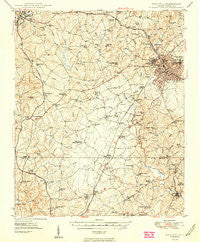
~ Rock Hill SC topo map, 1:62500 scale, 15 X 15 Minute, Historical, 1949
Rock Hill, South Carolina, USGS topographic map dated 1949.
Includes geographic coordinates (latitude and longitude). This topographic map is suitable for hiking, camping, and exploring, or framing it as a wall map.
Printed on-demand using high resolution imagery, on heavy weight and acid free paper, or alternatively on a variety of synthetic materials.
Topos available on paper, Waterproof, Poly, or Tyvek. Usually shipping rolled, unless combined with other folded maps in one order.
- Product Number: USGS-5388924
- Free digital map download (high-resolution, GeoPDF): Rock Hill, South Carolina (file size: 9 MB)
- Map Size: please refer to the dimensions of the GeoPDF map above
- Weight (paper map): ca. 55 grams
- Map Type: POD USGS Topographic Map
- Map Series: HTMC
- Map Verison: Historical
- Cell ID: 61676
- Scan ID: 261930
- Aerial Photo Year: 1941
- Survey Year: 1947
- Datum: NAD27
- Map Projection: Polyconic
- Map published by United States Geological Survey
- Map Language: English
- Scanner Resolution: 600 dpi
- Map Cell Name: Rock Hill
- Grid size: 15 X 15 Minute
- Date on map: 1949
- Map Scale: 1:62500
- Geographical region: South Carolina, United States
Neighboring Maps:
All neighboring USGS topo maps are available for sale online at a variety of scales.
Spatial coverage:
Topo map Rock Hill, South Carolina, covers the geographical area associated the following places:
- Laney Terrace - Rodman - Clubside Estates - Brattonsville - Shiland Hills - Newport - Old Farm - Rock Hill - Wooded Valley - Stoneybrook Estates - Pineview - Trexler Acres - Quiet Acres - Tirzah - Lakeview Acres - Smith - Coventry Estates - Lowrys - Devonshire - Shadowbrook - Willow Acres - Deas Mill - Squire Estates - Country Oaks - McConnells - Forest Hills - Glenwood Acres - Monterey Hills - Church Hill Heights - Avondale Terrace - Quail Run - Cato Estates - Country Club Estates - Oakdale - Flint Hill - Fairlawn - Whispering Hills - Guthries - Swan Meadows - Brookwood - Lando - Miller Crossing - York - Old Point Station - Pineridge - College Farms - Ogden - Dinber - Beaty Estates - Matthews Estates - Greenfield Acres - Boyd Hill - Meadow Lakes - Belle Meade - Westerwood Acres - Clinton Park - Oakwood Acres - Kimberly Woods - Cedar Grove Park - Belair Acres - Kenilworth Acres - Musical Heights - Wood Forest - Sedgefield - Forest Hills - Steele Crossing - Southland Park - Rawlinson Acres - Delphia - Red Oaks - Oldwoods - Edgemoor - Ebenezer - Mexico - Ragin Estates - Heatherwood - Hicklin Crossing - Woodwind - Lewis - Camelot Woods - Wintercrest - Cedar Forest Acres - Oakdale Acres - Botany Woods - Winthrop Heights - Rawlinson Woods - Sunset Acres - Woodbridge
- Map Area ID: AREA3534.75-81.25-81
- Northwest corner Lat/Long code: USGSNW35-81.25
- Northeast corner Lat/Long code: USGSNE35-81
- Southwest corner Lat/Long code: USGSSW34.75-81.25
- Southeast corner Lat/Long code: USGSSE34.75-81
- Northern map edge Latitude: 35
- Southern map edge Latitude: 34.75
- Western map edge Longitude: -81.25
- Eastern map edge Longitude: -81


