
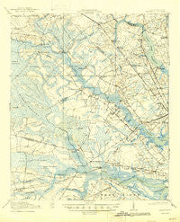
~ Ravenels SC topo map, 1:62500 scale, 15 X 15 Minute, Historical, 1920, updated 1945
Ravenels, South Carolina, USGS topographic map dated 1920.
Includes geographic coordinates (latitude and longitude). This topographic map is suitable for hiking, camping, and exploring, or framing it as a wall map.
Printed on-demand using high resolution imagery, on heavy weight and acid free paper, or alternatively on a variety of synthetic materials.
Topos available on paper, Waterproof, Poly, or Tyvek. Usually shipping rolled, unless combined with other folded maps in one order.
- Product Number: USGS-5388916
- Free digital map download (high-resolution, GeoPDF): Ravenels, South Carolina (file size: 9 MB)
- Map Size: please refer to the dimensions of the GeoPDF map above
- Weight (paper map): ca. 55 grams
- Map Type: POD USGS Topographic Map
- Map Series: HTMC
- Map Verison: Historical
- Cell ID: 61472
- Scan ID: 261925
- Imprint Year: 1945
- Survey Year: 1918
- Datum: NAD
- Map Projection: Polyconic
- Map published by United States Army Corps of Engineers
- Map published by United States Department of War
- Map Language: English
- Scanner Resolution: 600 dpi
- Map Cell Name: Ravenels
- Grid size: 15 X 15 Minute
- Date on map: 1920
- Map Scale: 1:62500
- Geographical region: South Carolina, United States
Neighboring Maps:
All neighboring USGS topo maps are available for sale online at a variety of scales.
Spatial coverage:
Topo map Ravenels, South Carolina, covers the geographical area associated the following places:
- Southern Palms - Fort Bull - Singing Pines - Castlewood - Creekside - Woodland Estates - Pepperhill - Huntington Woods - Fairlawn Terrace - Tranquil Estates - Russelldale - Oak Grove - Marlin Estates - Summerville Place - Otranto - Cooke Crossroads - Wilsonville - Sherwood Forest - Pierpont - Oak Ridge - Pineview Hills - Ladson - Ashley Acres - The Oaks - Coventry Place - Summerville Farms - Johns Island - Orleans Woods - Harbour Lake - Lambs - Ashley Heights - Cohen Hill - Indigo Point - Rantowles - Evergreen - Ashborough East - Dogwood Gardens - Hickory Hall Plantation - Belvedere - Essex Village - West Greenview Acres - Point Pleasant (historical) - Sylvia Lane - Country Club Estates - Magnolia Ranch - Deer Park - Long Branch Estates - Greenwood Park - Stallsville - Forest Lakes - Waters Edge - Capri Isles - Centerville - Plantation Ridge - Riverbend - Woodstock - Forestdale - Ferndale - Archdale - Chandler Village - Chandler Lakes - Runnymede - Jamison Terrace - Melrose - Limehouse Station - Orange Grove Estates - Hunley Park - Bennett - Parkdale - The Farms - Ashley Forest - Dorchester (historical) - Iron Gate - Ashley Hall Manor - Ashley Retreat - Dorchester Crossing - Northwood Estates - Evanston Estates - Marsh Cove - Saint Andrews Heights - Greenhurst - Murry Hill - Bon Aire - Westoe - Parsonage Point - Orleans Estates - Berry Hill - Green Grove - Midland Park - Shady Grove - Wappoo Shores - University Park - Sedgefield - Brentwood - Shell Point - Kings Grant - Oakmont - Plantation Estates - Crestwood - Faber Place
- Map Area ID: AREA3332.75-80.25-80
- Northwest corner Lat/Long code: USGSNW33-80.25
- Northeast corner Lat/Long code: USGSNE33-80
- Southwest corner Lat/Long code: USGSSW32.75-80.25
- Southeast corner Lat/Long code: USGSSE32.75-80
- Northern map edge Latitude: 33
- Southern map edge Latitude: 32.75
- Western map edge Longitude: -80.25
- Eastern map edge Longitude: -80


