
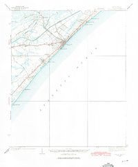
~ Myrtle Beach SC topo map, 1:62500 scale, 15 X 15 Minute, Historical, 1937, updated 1975
Myrtle Beach, South Carolina, USGS topographic map dated 1937.
Includes geographic coordinates (latitude and longitude). This topographic map is suitable for hiking, camping, and exploring, or framing it as a wall map.
Printed on-demand using high resolution imagery, on heavy weight and acid free paper, or alternatively on a variety of synthetic materials.
Topos available on paper, Waterproof, Poly, or Tyvek. Usually shipping rolled, unless combined with other folded maps in one order.
- Product Number: USGS-5388866
- Free digital map download (high-resolution, GeoPDF): Myrtle Beach, South Carolina (file size: 4 MB)
- Map Size: please refer to the dimensions of the GeoPDF map above
- Weight (paper map): ca. 55 grams
- Map Type: POD USGS Topographic Map
- Map Series: HTMC
- Map Verison: Historical
- Cell ID: 58218
- Scan ID: 261900
- Imprint Year: 1975
- Survey Year: 1937
- Datum: NAD27
- Map Projection: Polyconic
- Map published by United States Geological Survey
- Map Language: English
- Scanner Resolution: 600 dpi
- Map Cell Name: Myrtle Beach
- Grid size: 15 X 15 Minute
- Date on map: 1937
- Map Scale: 1:62500
- Geographical region: South Carolina, United States
Neighboring Maps:
All neighboring USGS topo maps are available for sale online at a variety of scales.
Spatial coverage:
Topo map Myrtle Beach, South Carolina, covers the geographical area associated the following places:
- Westwood Estates - Springmaid Beach - Ocean Forest - Myrtle Heights - Woodland Park - Pine Lake Estates - Benton Park - Pine Island - Myrtle Heights - Cypress Creek - Green Bay Park - Myrtle Beach - Ocean Lakes - Hurl Rocks - Caropine - Long Bay Estates - East Chester - Owens - Crystal Lake - Villa Woods - Stalvey - Blynn Acres - Myrtle Ridge - Ramsey Acres - Seacroft - Oak Park - Watergate - Seaview Place - Lakewood - Forest Dunes - Plantation Point - Longleaf - Lake Shore - Pinelands - Dogwood - Brookgate - Rosewood - Pebble Beach - Konig - Surfside Beach - Highlands - Washington Park - Oakland Heights - Forestbrook - Midway - Platt Spring - Prestwick - Surf Pines - Cane Patch - Cimerron Plantation South - Withers Heights - Deerfield Plantation - Scott Acres - Hunter Fields - Deer Track Villas - Tarpon Bay - Yaupon Circle - Fairway Park - Socastee - Long Bay - The Landing at Plantation Point - Oceanside Village
- Map Area ID: AREA33.7533.5-79-78.75
- Northwest corner Lat/Long code: USGSNW33.75-79
- Northeast corner Lat/Long code: USGSNE33.75-78.75
- Southwest corner Lat/Long code: USGSSW33.5-79
- Southeast corner Lat/Long code: USGSSE33.5-78.75
- Northern map edge Latitude: 33.75
- Southern map edge Latitude: 33.5
- Western map edge Longitude: -79
- Eastern map edge Longitude: -78.75


