
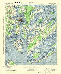
~ Fort Fremont SC topo map, 1:62500 scale, 15 X 15 Minute, Historical, 1944
Fort Fremont, South Carolina, USGS topographic map dated 1944.
Includes geographic coordinates (latitude and longitude). This topographic map is suitable for hiking, camping, and exploring, or framing it as a wall map.
Printed on-demand using high resolution imagery, on heavy weight and acid free paper, or alternatively on a variety of synthetic materials.
Topos available on paper, Waterproof, Poly, or Tyvek. Usually shipping rolled, unless combined with other folded maps in one order.
- Product Number: USGS-5388754
- Free digital map download (high-resolution, GeoPDF): Fort Fremont, South Carolina (file size: 12 MB)
- Map Size: please refer to the dimensions of the GeoPDF map above
- Weight (paper map): ca. 55 grams
- Map Type: POD USGS Topographic Map
- Map Series: HTMC
- Map Verison: Historical
- Cell ID: 54269
- Scan ID: 261842
- Woodland Tint: Yes
- Aerial Photo Year: 1939
- Survey Year: 1912
- Datum: NAD27
- Map Projection: Polyconic
- Map published by United States Army Corps of Engineers
- Map Language: English
- Scanner Resolution: 600 dpi
- Map Cell Name: Fort Fremont
- Grid size: 15 X 15 Minute
- Date on map: 1944
- Map Scale: 1:62500
- Geographical region: South Carolina, United States
Neighboring Maps:
All neighboring USGS topo maps are available for sale online at a variety of scales.
Spatial coverage:
Topo map Fort Fremont, South Carolina, covers the geographical area associated the following places:
- Hazel Farm - Pepper Hill - Morgan River Estates - Yacht Club Estates - Sangster Village - Port Royal - Marsh Hawk - Peace Haven - Academy Estates - Santa Elena (historical) - Red Bluff Estates - Colonial Heights - Shell Point park - Beaufort - Tanglewood - Hilton Head Plantation - Frogmore - Gay Oaks - Salem Plantation - Rivers Edge - Forest Fields - Springfield - Quail Run - Wilkins - Oakwood Park - Battery Marina Village - Grays Hill - Burton - Dowlingwood - Green Pond - Orange Grove - Colony Gardens Estates - Lucy Creek - Riverwind - Pleasant Point - Daniels - Bon Aire - Waterford Place - Salt Creek - Scott - Marsh Harbor - Ashdale - Mark Island - Attaway - Walnut Hill - Longwood - Mink Point Plantation - Shell Point - Fort Fremont - Roseida - Sherwood Forest - Cherry Hill Estates - Walling Grove - Country Club Bluff - Red Oak - Port Royal Landing - Blue Heron Bluff - James Byrnes Estates - Seabrook Landing - Partridge Woods - Mariners Watch - Magnolia Bluff - Polk Village - Royal Pines Country Club Estates - Walsh - Lands End - Dataw Island - Pine Hill Acres - Bluff Farm - Palmetto Estates
- Map Area ID: AREA32.532.25-80.75-80.5
- Northwest corner Lat/Long code: USGSNW32.5-80.75
- Northeast corner Lat/Long code: USGSNE32.5-80.5
- Southwest corner Lat/Long code: USGSSW32.25-80.75
- Southeast corner Lat/Long code: USGSSE32.25-80.5
- Northern map edge Latitude: 32.5
- Southern map edge Latitude: 32.25
- Western map edge Longitude: -80.75
- Eastern map edge Longitude: -80.5


