
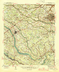
~ Florence West SC topo map, 1:62500 scale, 15 X 15 Minute, Historical, 1945
Florence West, South Carolina, USGS topographic map dated 1945.
Includes geographic coordinates (latitude and longitude). This topographic map is suitable for hiking, camping, and exploring, or framing it as a wall map.
Printed on-demand using high resolution imagery, on heavy weight and acid free paper, or alternatively on a variety of synthetic materials.
Topos available on paper, Waterproof, Poly, or Tyvek. Usually shipping rolled, unless combined with other folded maps in one order.
- Product Number: USGS-5388750
- Free digital map download (high-resolution, GeoPDF): Florence West, South Carolina (file size: 9 MB)
- Map Size: please refer to the dimensions of the GeoPDF map above
- Weight (paper map): ca. 55 grams
- Map Type: POD USGS Topographic Map
- Map Series: HTMC
- Map Verison: Historical
- Cell ID: 54204
- Scan ID: 261840
- Woodland Tint: Yes
- Survey Year: 1940
- Datum: NAD27
- Map Projection: Polyconic
- Map published by United States Geological Survey
- Map Language: English
- Scanner Resolution: 600 dpi
- Map Cell Name: Florence West
- Grid size: 15 X 15 Minute
- Date on map: 1945
- Map Scale: 1:62500
- Geographical region: South Carolina, United States
Neighboring Maps:
All neighboring USGS topo maps are available for sale online at a variety of scales.
Spatial coverage:
Topo map Florence West, South Carolina, covers the geographical area associated the following places:
- Sweetbriar - Williams Heights - Mayfair - Savannah Grove - Alexander Crossroads - Wilson Estates - Benson Acres - Country Club Estates - Coles Crossing - Cusac Crossroads - Wallace Crossroads - South Point - Woodland Park - Sunset Acres - Colonial Heights - Belleview - Jernigan Crossroads - Pine Grove - Pineneedles - Peniel Crossroads - Wilson Heights - Sansbury Crossroads - Philadelphia (historical) - Syracuse - Hobbs Crossroads - Kelly Farms - Muldrow Mill - Spaulding Heights - Springdale Place - Howe - Java - Sandhurst - Cypress Point - Lynches Mill - Sparrows Crossroads - Lee Acres - Ridgecrest - Johnson Crossroads - Camellia Gardens - Kings Grant - Arrowood - Grove Park - Briarcliff - Siesta Village - Huntington Place - Forest Lake South - Pleasant View (historical) - Ferndale - Oakdale - Deerfield - Cloisters - Longleaf - Old Court - Tarleton Estates - Palmetto Shores - Lazar Place - Rose Hill - Danwood - Laurelwood - Waterford - Elim - Wren Creek - Timmonsville - Farmwood - Village Green - College Park - Wilson Crossroads - Colonial Forest - Delmar Heights - Tara Hills - North Gate - Suburbia - Hamville (historical) - Jackson Crossroads - South Park - Crownland Estates - Ebenezer - Whitehall - Enchanted Meadows - Foxcroft - Nob Hill - Landmark Woods - Fairlane Estates - Windsor Forest - South Side - Pine Acres - Lakeside - New Hope - Ashwood Estates - Jones Crossroads - Tara Village - Oak Forest - Hollman Crossroads - Effingham - Hillcrest - Brook Green Park - Pine Forest Plantation - Sardis - Bannockburn - Florence
- Map Area ID: AREA34.2534-80-79.75
- Northwest corner Lat/Long code: USGSNW34.25-80
- Northeast corner Lat/Long code: USGSNE34.25-79.75
- Southwest corner Lat/Long code: USGSSW34-80
- Southeast corner Lat/Long code: USGSSE34-79.75
- Northern map edge Latitude: 34.25
- Southern map edge Latitude: 34
- Western map edge Longitude: -80
- Eastern map edge Longitude: -79.75


