
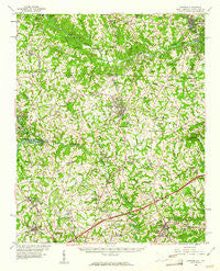
~ Cowpens SC topo map, 1:62500 scale, 15 X 15 Minute, Historical, 1959, updated 1961
Cowpens, South Carolina, USGS topographic map dated 1959.
Includes geographic coordinates (latitude and longitude). This topographic map is suitable for hiking, camping, and exploring, or framing it as a wall map.
Printed on-demand using high resolution imagery, on heavy weight and acid free paper, or alternatively on a variety of synthetic materials.
Topos available on paper, Waterproof, Poly, or Tyvek. Usually shipping rolled, unless combined with other folded maps in one order.
- Product Number: USGS-5388710
- Free digital map download (high-resolution, GeoPDF): Cowpens, South Carolina (file size: 10 MB)
- Map Size: please refer to the dimensions of the GeoPDF map above
- Weight (paper map): ca. 55 grams
- Map Type: POD USGS Topographic Map
- Map Series: HTMC
- Map Verison: Historical
- Cell ID: 53016
- Scan ID: 261817
- Imprint Year: 1961
- Woodland Tint: Yes
- Aerial Photo Year: 1955
- Field Check Year: 1959
- Datum: NAD27
- Map Projection: Polyconic
- Map published by United States Geological Survey
- Map Language: English
- Scanner Resolution: 600 dpi
- Map Cell Name: Cowpens
- Grid size: 15 X 15 Minute
- Date on map: 1959
- Map Scale: 1:62500
- Geographical region: South Carolina, United States
Neighboring Maps:
All neighboring USGS topo maps are available for sale online at a variety of scales.
Spatial coverage:
Topo map Cowpens, South Carolina, covers the geographical area associated the following places:
- Twin Creek - Peachtree Gardens - Brice - Macedonia - Mason Estates - Reynolds Mobile Home Park - Sunnydale Acres - Rainbow Park - Carlisle - Beverly Woods - Harris - Shoally Creek - Love Springs - Cannons Camp Ground - Springlake - Sherman Park - Cowpens - Clearview Heights - Thorn Ridge Mobile Home Park - Laurelwood - Midland Estates - Converse Road Mobile Home Park - Kentwood - Spring Hills - Brooklyn - North Hill Acres - Cherokee Springs - Enola - Springdale Estates - Whitlock Park - Valley Falls - Clearview Heights - Diamond J Mobile Home Park - Bellview Acres - Northbrook Park - Arrowwood - Thunderbird Mobile Home Park - Peach Valley Fairway Estates - Ezell (historical) - Cooley Springs - Mayo - Meadow Spring - Mountain View - Lakeview Manor - Northgate - Pinebrook Mobile Home Community - Canterbury Heights - Mayo Mills - Northwood - Panorama Estates - Luray Hills - State Line - Riverview Park - Fosters Grove - North Hills - Cliffside - Lynwood - Woodcreek - Chesnee - Ferndale - McGreegor Downs - Mountainbrook - Boiling Springs - Quail Ridge - Sandy Springs
- Map Area ID: AREA35.2535-82-81.75
- Northwest corner Lat/Long code: USGSNW35.25-82
- Northeast corner Lat/Long code: USGSNE35.25-81.75
- Southwest corner Lat/Long code: USGSSW35-82
- Southeast corner Lat/Long code: USGSSE35-81.75
- Northern map edge Latitude: 35.25
- Southern map edge Latitude: 35
- Western map edge Longitude: -82
- Eastern map edge Longitude: -81.75


