
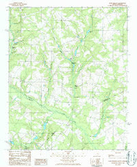
~ Pond Branch SC topo map, 1:24000 scale, 7.5 X 7.5 Minute, Historical, 1986, updated 1986
Pond Branch, South Carolina, USGS topographic map dated 1986.
Includes geographic coordinates (latitude and longitude). This topographic map is suitable for hiking, camping, and exploring, or framing it as a wall map.
Printed on-demand using high resolution imagery, on heavy weight and acid free paper, or alternatively on a variety of synthetic materials.
Topos available on paper, Waterproof, Poly, or Tyvek. Usually shipping rolled, unless combined with other folded maps in one order.
- Product Number: USGS-5388052
- Free digital map download (high-resolution, GeoPDF): Pond Branch, South Carolina (file size: 11 MB)
- Map Size: please refer to the dimensions of the GeoPDF map above
- Weight (paper map): ca. 55 grams
- Map Type: POD USGS Topographic Map
- Map Series: HTMC
- Map Verison: Historical
- Cell ID: 35937
- Scan ID: 261460
- Imprint Year: 1986
- Woodland Tint: Yes
- Aerial Photo Year: 1981
- Edit Year: 1986
- Field Check Year: 1983
- Datum: NAD27
- Map Projection: Universal Transverse Mercator
- Provisional map: Yes
- Map published by United States Geological Survey
- Map Language: English
- Scanner Resolution: 600 dpi
- Map Cell Name: Pond Branch
- Grid size: 7.5 X 7.5 Minute
- Date on map: 1986
- Map Scale: 1:24000
- Geographical region: South Carolina, United States
Neighboring Maps:
All neighboring USGS topo maps are available for sale online at a variety of scales.
Spatial coverage:
Topo map Pond Branch, South Carolina, covers the geographical area associated the following places:
- Corinth Church - Culler Pond - Corbett Lake - Lexington County Fire Service Mack Edisto - Saint Paul Church - Jeffcoat - Chaney Cemetery - Ebenezer Methodist Church - Livingston Mill (historical) - Swansea Evangelical Church - Hollow Creek - Central Hill School (historical) - Caughman Lake - Maloney School (historical) - Pooles Upper Millpond - Shumpert Pond - Jeffcoat Bridge - Neese Cemetery - South Carolina Noname 38070 D-3682 Dam - Salem Creek - Pleasant Hill School (historical) - North Edisto School - Jerusalem Church - Hollow Creek Fire Department - Chapel Hill Church - South Carolina Noname 32079 D-1005 Dam - Central Church - Pooles Millpond - Jackson Branch - Brooker Pond - Chapel Hill Baptist Church Cemetery - Hunter Branch - Pooles Upper Millpond - Darlan School - Culler Ponds - Little Hollow Creek - Kings Pond - South Carolina Noname 02030 D-2051 Dam - Hall Hill Church - South Carolina Noname 32022 D-0980 Dam - Mount Beulah School (historical) - Salem Church - Leaird Cemetery - Pond Branch - Jacksons Pond - South Carolina Noname 02094 D-2164 Dam - Macks School (historical) - Thrasher Branch - Leffcoots Millpond - Kings Grove Church - South Carolina Noname 32023 D-1004 Dam - Crawford Branch - Salem Baptist Church Cemetery - Bodie School (historical) - South Carolina Noname 02027 D-2052 Dam - Hooker Cemetery - Pooles Millpond - Maloney Church - Chapel Hill Baptist Church Cemetery
- Map Area ID: AREA33.7533.625-81.25-81.125
- Northwest corner Lat/Long code: USGSNW33.75-81.25
- Northeast corner Lat/Long code: USGSNE33.75-81.125
- Southwest corner Lat/Long code: USGSSW33.625-81.25
- Southeast corner Lat/Long code: USGSSE33.625-81.125
- Northern map edge Latitude: 33.75
- Southern map edge Latitude: 33.625
- Western map edge Longitude: -81.25
- Eastern map edge Longitude: -81.125


