
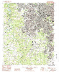
~ Greenville SC topo map, 1:24000 scale, 7.5 X 7.5 Minute, Historical, 1983, updated 1983
Greenville, South Carolina, USGS topographic map dated 1983.
Includes geographic coordinates (latitude and longitude). This topographic map is suitable for hiking, camping, and exploring, or framing it as a wall map.
Printed on-demand using high resolution imagery, on heavy weight and acid free paper, or alternatively on a variety of synthetic materials.
Topos available on paper, Waterproof, Poly, or Tyvek. Usually shipping rolled, unless combined with other folded maps in one order.
- Product Number: USGS-5387314
- Free digital map download (high-resolution, GeoPDF): Greenville, South Carolina (file size: 19 MB)
- Map Size: please refer to the dimensions of the GeoPDF map above
- Weight (paper map): ca. 55 grams
- Map Type: POD USGS Topographic Map
- Map Series: HTMC
- Map Verison: Historical
- Cell ID: 18456
- Scan ID: 261073
- Imprint Year: 1983
- Woodland Tint: Yes
- Aerial Photo Year: 1976
- Edit Year: 1983
- Field Check Year: 1977
- Datum: NAD27
- Map Projection: Lambert Conformal Conic
- Map published by United States Geological Survey
- Map Language: English
- Scanner Resolution: 600 dpi
- Map Cell Name: Greenville
- Grid size: 7.5 X 7.5 Minute
- Date on map: 1983
- Map Scale: 1:24000
- Geographical region: South Carolina, United States
Neighboring Maps:
All neighboring USGS topo maps are available for sale online at a variety of scales.
Spatial coverage:
Topo map Greenville, South Carolina, covers the geographical area associated the following places:
- Holly Springs - City View - Parker - Chestnut Hills - Chanticleer - Palmetto Terrace - Cutler Ridge - Brandon - Monaghan - Alta Vista - West Gantt - Cleveland Forest - Biltmore - Riverside - East Gantt - Park Place - Roseman Heights - Oxford Acres - Dunean - Gantt - Judson - Carolina Heights - Woodside - Supreme Forest - Welcome Acres - North Hills - White Horse - Lockwood Heights - Woodfield Heights - Fairfield Acres - Stone Lake - Glendale - Royal Oaks - Pleasant Valley - Pecan Terrace - Farmington Acres - West Greenville - Rockvale - Club Forest - Roosevelt Heights - Belaire Estates - Woodbriar - Welcome - Plainview Heights - Poinsett - Tanglewood - White Horse Heights - Brookforest Estates - Sampson - Spring Brook Terrace - Sunny Acres - Dreher Colony - Mountain View Homes - Oak Crest - Crosswell - Mansfield Park - Riley Estates - Hughes Heights - Traxler Park - Knollwood - Enchanted Forest - Quail Haven - University Ridge Homes - Pine Hill Village - South Forest Estates - Westville - Carver Park - Boyce Lawn - Athelone Heights - Belle Meade - Woodfields - Powdersville - Smith Heights - White Oak Hills - Park Lane Terrace - Greenville - View Point Place - The Highlands - Lakeside - Staunton Heights - Elizabeth Heights - Westcliffe - Overbrook
- Map Area ID: AREA34.87534.75-82.5-82.375
- Northwest corner Lat/Long code: USGSNW34.875-82.5
- Northeast corner Lat/Long code: USGSNE34.875-82.375
- Southwest corner Lat/Long code: USGSSW34.75-82.5
- Southeast corner Lat/Long code: USGSSE34.75-82.375
- Northern map edge Latitude: 34.875
- Southern map edge Latitude: 34.75
- Western map edge Longitude: -82.5
- Eastern map edge Longitude: -82.375


