
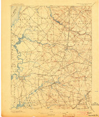
~ Salem NJ topo map, 1:62500 scale, 15 X 15 Minute, Historical, 1898, updated 1903
Salem, New Jersey, USGS topographic map dated 1898.
Includes geographic coordinates (latitude and longitude). This topographic map is suitable for hiking, camping, and exploring, or framing it as a wall map.
Printed on-demand using high resolution imagery, on heavy weight and acid free paper, or alternatively on a variety of synthetic materials.
Topos available on paper, Waterproof, Poly, or Tyvek. Usually shipping rolled, unless combined with other folded maps in one order.
- Product Number: USGS-5377524
- Free digital map download (high-resolution, GeoPDF): Salem, New Jersey (file size: 9 MB)
- Map Size: please refer to the dimensions of the GeoPDF map above
- Weight (paper map): ca. 55 grams
- Map Type: POD USGS Topographic Map
- Map Series: HTMC
- Map Verison: Historical
- Cell ID: 62024
- Scan ID: 255354
- Imprint Year: 1903
- Survey Year: 1886
- Datum: Unstated
- Map Projection: Unstated
- Map published by United States Geological Survey
- Map Language: English
- Scanner Resolution: 600 dpi
- Map Cell Name: Salem
- Grid size: 15 X 15 Minute
- Date on map: 1898
- Map Scale: 1:62500
- Geographical region: New Jersey, United States
Neighboring Maps:
All neighboring USGS topo maps are available for sale online at a variety of scales.
Spatial coverage:
Topo map Salem, New Jersey, covers the geographical area associated the following places:
- Sinnickson Landing - Cohansey - Eldridge Hill - Oakland - Beals Mill - Richmantown - Golf View - Seven Stars - East Lake - Mannington Mills - Cedar Crest Manor - Remsterville - Dilkes Mills - Welchville - Penton - Foxs Mill - Golf Manor - Raines Corner - Stockington - Marshalltown - Mower - Kay Gardens - Yorktown - Acton - Fenwick - Slapes Corner - Watson Corner - Harrisonville - Biddles Landing - South Penns Grove - Deepwater - Hancocks Bridge - Penns Grove - Ballingers Mill - Marlton Heights - Perkintown - Woods Upper Mill - Cobbs Mill - Slabtown - Milltown - Paradise Lakes - Halltown - Harmony - Aldine - Woodstown - Courses Landing - Woodmere - Glenside - Paulding - Riddleton - Pointers - Danceys Corner - Friendship Station - Daretown - Alloway - Beaver Dam - Union Grove - Hagerville - Porches Mill - Woods Mills - Point Airy - Watsons Corner - Auburn - Portertown - Salem - Sharptown - Carneys Point - Cedarville - Ordmont - Elks Terrace - Swedesboro - Moores Corner - Friesburg - Quinton - Alloway Junction - Pecks Corner - Harrisonville
- Map Area ID: AREA39.7539.5-75.5-75.25
- Northwest corner Lat/Long code: USGSNW39.75-75.5
- Northeast corner Lat/Long code: USGSNE39.75-75.25
- Southwest corner Lat/Long code: USGSSW39.5-75.5
- Southeast corner Lat/Long code: USGSSE39.5-75.25
- Northern map edge Latitude: 39.75
- Southern map edge Latitude: 39.5
- Western map edge Longitude: -75.5
- Eastern map edge Longitude: -75.25


