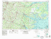
~ Rocky Mount NC topo map, 1:250000 scale, 1 X 2 Degree, Historical, 1953, updated 1984
Rocky Mount, North Carolina, USGS topographic map dated 1953.
Includes geographic coordinates (latitude and longitude). This topographic map is suitable for hiking, camping, and exploring, or framing it as a wall map.
Printed on-demand using high resolution imagery, on heavy weight and acid free paper, or alternatively on a variety of synthetic materials.
Topos available on paper, Waterproof, Poly, or Tyvek. Usually shipping rolled, unless combined with other folded maps in one order.
- Product Number: USGS-5375050
- Free digital map download (high-resolution, GeoPDF): Rocky Mount, North Carolina (file size: 21 MB)
- Map Size: please refer to the dimensions of the GeoPDF map above
- Weight (paper map): ca. 55 grams
- Map Type: POD USGS Topographic Map
- Map Series: HTMC
- Map Verison: Historical
- Cell ID: 68991
- Scan ID: 164769
- Imprint Year: 1984
- Woodland Tint: Yes
- Visual Version Number: 2
- Aerial Photo Year: 1976
- Edit Year: 1980
- Field Check Year: 1953
- Datum: NAD27
- Map Projection: Transverse Mercator
- Map published by United States Geological Survey
- Map Language: English
- Scanner Resolution: 600 dpi
- Map Cell Name: Rocky Mount
- Grid size: 1 X 2 Degree
- Date on map: 1953
- Map Scale: 1:250000
- Geographical region: North Carolina, United States
Neighboring Maps:
All neighboring USGS topo maps are available for sale online at a variety of scales.
Spatial coverage:
Topo map Rocky Mount, North Carolina, covers the geographical area associated the following places:
- Sandy Landing - Riverdale - Westover - Eastwood - Jackson Heights Mobile Home Park - Fremont - Candlewick Estates - Mary Beth Park - Bell Fork - Millers Store - Mimosa Shores - Nobles Crossroads - Edgefield Forest - Speights Bridge - Congleton - River Road - Bay City - Bath - Pecan Grove Mobile Home Park - Green Hill (historical) - Scuppernong - Airboro - Liberty Hill Park - Pleasant View - Evans Park - Random Woods - Grove Park - Oakhurst - Castle Oaks - Coley Acres - Eastwood - Dellwood - Pinetown - Parrots - Berkeley Village - Spring Creek - Cambridge - Devonshire Square - Grabtown - Meadow Brook - Hazelwood Park - Tiffany Gardens - Phillips Crossroads - Rivermont - Suggs Crossroads - Stoney Creek Mobile Home Park - Hill View - Lima - Pine Haven - Black Creek - Thorpshire Farm - Pine Crest - Halifax Crossing - Colony Estates - Sawyers Mobile Home Park - Washington Park - Winterville - British Woods - Swindell - Gilead - Rodmans Quarter - Stilley - Cypress Shores - Rountree - Hood Swamp - Dover - Whortonsville - Davenport Forks - Daisy Siding - Schoolhouse Landing - Johnsons Mills (historical) - Carmur - Pungo - Vinson Manor - Belvoir - Winsteadville - Cobb Town - Patsy Bran Mobile Home Park - Alvah Hardy Jr Mobile Home Park - Old Ford - Breckenridge - Ayden - Eastover - Woodgreen - Pleasant Grove - Haslin Corner - Beach Grove - Plymouth - Tugwell (historical) - Fourway - Porter Junction - Whichard Beach - Dupree Crossroads - Sans Souci - Caseys Trailer Lodge - Goat Neck - Blount - Hugo - Mills Ridge - Bel-Air
- Map Area ID: AREA3635-78-76
- Northwest corner Lat/Long code: USGSNW36-78
- Northeast corner Lat/Long code: USGSNE36-76
- Southwest corner Lat/Long code: USGSSW35-78
- Southeast corner Lat/Long code: USGSSE35-76
- Northern map edge Latitude: 36
- Southern map edge Latitude: 35
- Western map edge Longitude: -78
- Eastern map edge Longitude: -76

