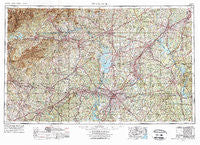
~ Charlotte NC topo map, 1:250000 scale, 1 X 2 Degree, Historical, 1953, updated 1975
Charlotte, North Carolina, USGS topographic map dated 1953.
Includes geographic coordinates (latitude and longitude). This topographic map is suitable for hiking, camping, and exploring, or framing it as a wall map.
Printed on-demand using high resolution imagery, on heavy weight and acid free paper, or alternatively on a variety of synthetic materials.
Topos available on paper, Waterproof, Poly, or Tyvek. Usually shipping rolled, unless combined with other folded maps in one order.
- Product Number: USGS-5375012
- Free digital map download (high-resolution, GeoPDF): Charlotte, North Carolina (file size: 25 MB)
- Map Size: please refer to the dimensions of the GeoPDF map above
- Weight (paper map): ca. 55 grams
- Map Type: POD USGS Topographic Map
- Map Series: HTMC
- Map Verison: Historical
- Cell ID: 68711
- Scan ID: 164186
- Imprint Year: 1975
- Woodland Tint: Yes
- Visual Version Number: 2
- Aerial Photo Year: 1972
- Edit Year: 1974
- Field Check Year: 1953
- Datum: Unstated
- Map Projection: Transverse Mercator
- Map published by United States Geological Survey
- Map Language: English
- Scanner Resolution: 600 dpi
- Map Cell Name: Charlotte
- Grid size: 1 X 2 Degree
- Date on map: 1953
- Map Scale: 1:250000
- Geographical region: North Carolina, United States
Neighboring Maps:
All neighboring USGS topo maps are available for sale online at a variety of scales.
Spatial coverage:
Topo map Charlotte, North Carolina, covers the geographical area associated the following places:
- Ravenwood - Sunset Hills - Shoally Creek - Cherokee Springs - Clubview Acres - Hickory Hill - Yorkwood - Greenbriar - Monbo - Gilkey - Harrison (historical) - Kentwood - Shady Brook - The Meadow Apartments - Fulton (historical) - Tuskasaga (historical) - Hollis - North Concord - Beaverbrook - Eastover Acres - Panorama Estates - Webbs - Cleveland Spring (historical) - Ostwalt - Glenwood - Buffalo - Crowders (historical) - Manchester - Pinedell - Landsdowne - Woodsdale - Arcadia - Sardis Cove - Forest Hills - Bethel (historical) - Piedmont Springs - Rhodhiss - Vashti - Midway - Concord - Weddington - Pumpkin Center - Little River - Table Rock - Washburn - East Marion - Hedrick Grove - Henry River - Sycamore Acres - Oxford Park - Five Forks - Shannon Park - Coulwood Hills - Singing Springs - Martindale (historical) - Advent Crossroads - Hornets Nest (historical) - Laboratory - Knob Creek - Frog Level - West Lenoir - Grassy Pond - Steelberry Acres - Pinebrook Mobile Home Community - Jersey - Wesley Park - Fox Run - New Home - Albemarle - Chipley Park - Carosel Apartments - Ashley Heights - Ora - Fountain Hill - Charlesmont - Reynolds Mobile Home Park - Faith - Nebo - Indian Trail - Sardis Patio - Dellview - Oakland - Orchard Hills - Brindletown - Dixie - Good (historical) - LeMar Park - Glenburine (historical) - Lockeland - Liberty Hill (historical) - Lattimore - Chateau Woods - Newton - Moores (historical) - Providence Mill - Arrowood - Ranlo - North Hill Acres - University Place - Hidden Acres Estates
- Map Area ID: AREA3635-82-80
- Northwest corner Lat/Long code: USGSNW36-82
- Northeast corner Lat/Long code: USGSNE36-80
- Southwest corner Lat/Long code: USGSSW35-82
- Southeast corner Lat/Long code: USGSSE35-80
- Northern map edge Latitude: 36
- Southern map edge Latitude: 35
- Western map edge Longitude: -82
- Eastern map edge Longitude: -80

