
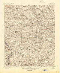
~ Statesville NC topo map, 1:125000 scale, 30 X 30 Minute, Historical, 1893, updated 1945
Statesville, North Carolina, USGS topographic map dated 1893.
Includes geographic coordinates (latitude and longitude). This topographic map is suitable for hiking, camping, and exploring, or framing it as a wall map.
Printed on-demand using high resolution imagery, on heavy weight and acid free paper, or alternatively on a variety of synthetic materials.
Topos available on paper, Waterproof, Poly, or Tyvek. Usually shipping rolled, unless combined with other folded maps in one order.
- Product Number: USGS-5374982
- Free digital map download (high-resolution, GeoPDF): Statesville, North Carolina (file size: 9 MB)
- Map Size: please refer to the dimensions of the GeoPDF map above
- Weight (paper map): ca. 55 grams
- Map Type: POD USGS Topographic Map
- Map Series: HTMC
- Map Verison: Historical
- Cell ID: 66688
- Scan ID: 164631
- Imprint Year: 1945
- Survey Year: 1891
- Datum: Unstated
- Map Projection: Polyconic
- Map published by United States Geological Survey
- Map Language: English
- Scanner Resolution: 600 dpi
- Map Cell Name: Statesville
- Grid size: 30 X 30 Minute
- Date on map: 1893
- Map Scale: 1:125000
- Geographical region: North Carolina, United States
Neighboring Maps:
All neighboring USGS topo maps are available for sale online at a variety of scales.
Spatial coverage:
Topo map Statesville, North Carolina, covers the geographical area associated the following places:
- Sunrise Park - Mount Vernon - Bostian Heights - Eastfield Estates - Barium Springs - Statesville West - Broadview - Holly Park - Matthew (historical) - Bloomfield - Mayhew - Cool Springs - Milford Terrace - Iredell Heights - Eufola - Mocksville - Corriher Heights - China Grove - North Kannapolis - Orchard Hills - Harmony - Brookgreen - Pittsburg - Chowansville (historical) - Meadow View - Westover - Milford Hills - Mount Mourne - Shinnville - Liberty Hill (historical) - Unity (historical) - Brookmeade - Greencrest - Beverly Heights - Valley Stream - Northmont - Elmwood - Nelly Green Estates - Loray - Frohock Mill site - Cana - Berkshire Hills - Needmore - Maine - Gather (historical) - Mitchell Aire - Monbo - Central - Shannon Acres - Grimes (historical) - Ephesus - Statesville - Rowan Mills - Old Farm - West Statesville - Torrance (historical) - Love Valley - East Monbo - Harts (historical) - Mount Ulla - Dal-Wan Heights - Smith Grove - Turnersburg - Cowin (historical) - Monticello Heights - Frohock Mill (historical) - Bells Crossroads - Houstonville (historical) - Mill Bridge - Lincoln Heights - Oakland Heights - Northview - Woodbridge Run - Westport - Ashbrook Park - Ostwalt - Bailey Hills - Lake Norman - Cleveland - Shepherds - Woodleaf - Terrell - Troutman - Doolie - Mazeppa - Mooresville - Wendover Hills - Chipley Park - Cedar Hills - Mill Hill (historical) - Cloverdale - Miranda (historical) - Ourdell - Eastover Acres - Dobbins (historical) - Landis - Farmland Acres - Baymount Meadows - Westcliff - Long Island
- Map Area ID: AREA3635.5-81-80.5
- Northwest corner Lat/Long code: USGSNW36-81
- Northeast corner Lat/Long code: USGSNE36-80.5
- Southwest corner Lat/Long code: USGSSW35.5-81
- Southeast corner Lat/Long code: USGSSE35.5-80.5
- Northern map edge Latitude: 36
- Southern map edge Latitude: 35.5
- Western map edge Longitude: -81
- Eastern map edge Longitude: -80.5


