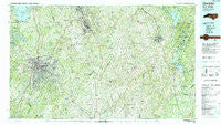
~ Charlotte NC topo map, 1:100000 scale, 30 X 60 Minute, Historical, 1985, updated 1991
Charlotte, North Carolina, USGS topographic map dated 1985.
Includes geographic coordinates (latitude and longitude). This topographic map is suitable for hiking, camping, and exploring, or framing it as a wall map.
Printed on-demand using high resolution imagery, on heavy weight and acid free paper, or alternatively on a variety of synthetic materials.
Topos available on paper, Waterproof, Poly, or Tyvek. Usually shipping rolled, unless combined with other folded maps in one order.
- Product Number: USGS-5374782
- Free digital map download (high-resolution, GeoPDF): Charlotte, North Carolina (file size: 34 MB)
- Map Size: please refer to the dimensions of the GeoPDF map above
- Weight (paper map): ca. 55 grams
- Map Type: POD USGS Topographic Map
- Map Series: HTMC
- Map Verison: Historical
- Cell ID: 67273
- Scan ID: 161074
- Imprint Year: 1991
- Woodland Tint: Yes
- Aerial Photo Year: 1984
- Edit Year: 1985
- Datum: NAD27
- Map Projection: Universal Transverse Mercator
- Map published by United States Geological Survey
- Map Language: English
- Scanner Resolution: 600 dpi
- Map Cell Name: Charlotte
- Grid size: 30 X 60 Minute
- Date on map: 1985
- Map Scale: 1:100000
- Geographical region: North Carolina, United States
Neighboring Maps:
All neighboring USGS topo maps are available for sale online at a variety of scales.
Spatial coverage:
Topo map Charlotte, North Carolina, covers the geographical area associated the following places:
- Pellyn Wood - Rocky River - Southbourne - Allen - Fox Run - Candlewood - Yorkwood - Casa Linda Estates - Caldwell - Pharrs Mill - Elizabeth - Deerhurst - Firestone - Grey Rock - Sherwood Forest - Rhyne - Carowood - Cold Water - Enderly Park - Berryhill - Bosts Mill (historical) - Southpark - Colonial Heights - Holiday Shores - Georgeville - Rolling Acres - North Concord - Querys Dixons (historical) - Pine Ridge - Embassy East - Hoskins - Cowans Ford - Hebron (historical) - Taragate Farms - Carmel - Currituck - New Gilead - Water Oak - Fairfield Plantation - Yorkmont - Druid Hills - Old Providence - Coulwood Hills - Olive Branch - Pioneer Mills - Sardis Patio - Singing Springs - Northwood - Sardis Cove - Twelve Oaks - Lebanon Heights - Greenbriar Woods - Wildwood - Autumnwood - Kirkland (historical) - Ravenwood - Shady Brook - Oakdale - Mint Hill - Holly Hills - Sterling - Cedar Village - Tanglewood - Pinecrest - Falcon Bridge - Cannon Crossroads - Wildwoods - Westerly Hill - Fox Run - Locust - Providence Plantation - Providence - Carolina Forest - Rosemont - Burnsville - Fort Mill - Cottonville - Smithville - Idelwile Brooke - Shannon Park - Roper (historical) - Cotswold - Parkview East - Severville - Providence Park - Pee Dee - Eastwood Park - Kimberly Courts - Old Orchid - Clubview Acres - Bahama Park - Coddle Creek (historical) - Crater Park - Orchard Knoll - Harrison (historical) - Norwood - Olde Heritage - Monteith (historical) - Gatewood - Bakers
- Map Area ID: AREA35.535-81-80
- Northwest corner Lat/Long code: USGSNW35.5-81
- Northeast corner Lat/Long code: USGSNE35.5-80
- Southwest corner Lat/Long code: USGSSW35-81
- Southeast corner Lat/Long code: USGSSE35-80
- Northern map edge Latitude: 35.5
- Southern map edge Latitude: 35
- Western map edge Longitude: -81
- Eastern map edge Longitude: -80

