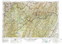
~ Cumberland MD topo map, 1:250000 scale, 1 X 2 Degree, Historical, 1956, updated 1981
Cumberland, Maryland, USGS topographic map dated 1956.
Includes geographic coordinates (latitude and longitude). This topographic map is suitable for hiking, camping, and exploring, or framing it as a wall map.
Printed on-demand using high resolution imagery, on heavy weight and acid free paper, or alternatively on a variety of synthetic materials.
Topos available on paper, Waterproof, Poly, or Tyvek. Usually shipping rolled, unless combined with other folded maps in one order.
- Product Number: USGS-5368748
- Free digital map download (high-resolution, GeoPDF): Cumberland, Maryland (file size: 30 MB)
- Map Size: please refer to the dimensions of the GeoPDF map above
- Weight (paper map): ca. 55 grams
- Map Type: POD USGS Topographic Map
- Map Series: HTMC
- Map Verison: Historical
- Cell ID: 68734
- Scan ID: 257776
- Imprint Year: 1981
- Woodland Tint: Yes
- Aerial Photo Year: 1952
- Edit Year: 1969
- Field Check Year: 1956
- Datum: NAD27
- Map Projection: Transverse Mercator
- Map published by United States Geological Survey
- Map Language: English
- Scanner Resolution: 600 dpi
- Map Cell Name: Cumberland
- Grid size: 1 X 2 Degree
- Date on map: 1956
- Map Scale: 1:250000
- Geographical region: Maryland, United States
Neighboring Maps:
All neighboring USGS topo maps are available for sale online at a variety of scales.
Spatial coverage:
Topo map Cumberland, Maryland, covers the geographical area associated the following places:
- Stringtown - Rainsburg - Waterloo - Bowling Green - Fossilville - New Centerville - Philson - New Salem - Vances Mill - Bloomery - Fort Hill - Ohiopyle - Hunters Valley - Lesmalinston - Lake Lynn - Auvil - Pleasant Valley - Senseny Heights - Dillons Run (historical) - Warnocks - Cats Run Junction - Wagoner - Ash Hollow Estates - Gebhart - Forest Park - Sir John Addition - Montel - Barrelville - Arcadia Mobile Home Park - Horseshoe Curve - Maysville - Oriole (historical) - Hartmansville - North Branch - Robinsonville - Emery - Ellerslie - Williamsport - Hogue Creek Estates - Richford (historical) - Wickham - Mount Vernon - Warfordsburg - Uniontown - Strecker - Saint Paul - Franklin - Amblersburg - Pioneer Rocks - Wolfe Mill - New Creek - Hiram - Addison - Point View - Heritage Hills - Goose Nest - West Van Voorhis - Cumberland - Davis - Youngstown - New Lexington - Fieldcrest - Ridgedale - East Riverside - Nordic Village - Pleasant Run - Northcraft (historical) - Big Cove Tannery - Woodburn - Saint George - Shanghai - Sharpe - Bard - Plummer - Morton Grove - Browns Chapel - Salco - Doman (historical) - McComas Beach - Pinto - Piney Grove - Ronco - Cumberland Village - Shanty Town (historical) - Mench - Niverton - Emoryville - South Uniontown - Tulip - Crucible - Amaranth - Kessel - Twiggtown - Allison - Chambersville - Jordan Run - Lake Frederick - Wilmoth (historical) - Mount Pisgah - Orr
- Map Area ID: AREA4039-80-78
- Northwest corner Lat/Long code: USGSNW40-80
- Northeast corner Lat/Long code: USGSNE40-78
- Southwest corner Lat/Long code: USGSSW39-80
- Southeast corner Lat/Long code: USGSSE39-78
- Northern map edge Latitude: 40
- Southern map edge Latitude: 39
- Western map edge Longitude: -80
- Eastern map edge Longitude: -78


