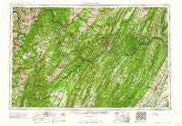
~ Cumberland MD topo map, 1:250000 scale, 1 X 2 Degree, Historical, 1962
Cumberland, Maryland, USGS topographic map dated 1962.
Includes geographic coordinates (latitude and longitude). This topographic map is suitable for hiking, camping, and exploring, or framing it as a wall map.
Printed on-demand using high resolution imagery, on heavy weight and acid free paper, or alternatively on a variety of synthetic materials.
Topos available on paper, Waterproof, Poly, or Tyvek. Usually shipping rolled, unless combined with other folded maps in one order.
- Product Number: USGS-5368740
- Free digital map download (high-resolution, GeoPDF): Cumberland, Maryland (file size: 26 MB)
- Map Size: please refer to the dimensions of the GeoPDF map above
- Weight (paper map): ca. 55 grams
- Map Type: POD USGS Topographic Map
- Map Series: HTMC
- Map Verison: Historical
- Cell ID: 68734
- Scan ID: 257770
- Woodland Tint: Yes
- Field Check Year: 1956
- Datum: Unstated
- Map Projection: Transverse Mercator
- Map published by United States Geological Survey
- Map Language: English
- Scanner Resolution: 600 dpi
- Map Cell Name: Cumberland
- Grid size: 1 X 2 Degree
- Date on map: 1962
- Map Scale: 1:250000
- Geographical region: Maryland, United States
Neighboring Maps:
All neighboring USGS topo maps are available for sale online at a variety of scales.
Spatial coverage:
Topo map Cumberland, Maryland, covers the geographical area associated the following places:
- Oldtown - Church Hill - Evans - Douglas - Upper Middletown - Chestnut Ridge - Sturgisson - Lake Ford - Shober - Buena (historical) - Continental Number 2 - Ash Hollow Estates - Salem - Sea Right - Cacapehon - Wickham - Dans Run - Needmore - Barnes Mill - Tanglewood - Rush - Stonybreak - Doman (historical) - Andover - Laurel Run - Noswad (historical) - Pioneer Rocks - Wilde Acres - Glen Savage - Threefork Bridge - Florence (historical) - Location - Woodside - Capon Lake - Kirk Woods - Carlos - Skyline - East End - Claysville - Bubbling Spring - Hibbs - Grahamtown - Mapleton (historical) - Cunningham - McKenzie - Rock Hall - Morgan - Calhoun - Mable Hill - Limestone - Oliver - Cedar Creek Battlefield - Plummer - Pleasant Valley - Normalville - Tuckertown - Gatzmer - Sylvan Lane - Hartmansville - Pettit (historical) - Hiram - Jerome Park - Davis Ford - Welltown - Websters Mill - Gum Spring - Mechanicsburg - Heritage Hills - Georges Creek - Loom - South Cumberland - Gannon - Big Pool - Carmichaels - Fiketown - Little Summit - Porters (historical) - De Haven - New Geneva - Hilderbrand - Nieswanders Fort - East Vindex - McCauley - Greater Point Marion - Somerfield - Herrington Manor - Mill Run Junction - Harmony Grove - Kernstown - Eckhart Junction - Millesons Mill - William - Dellslow - Mount Vernon - Zihlman - Chadville - Dawson - Mill Run - Lonaconing - West Bend
- Map Area ID: AREA4039-80-78
- Northwest corner Lat/Long code: USGSNW40-80
- Northeast corner Lat/Long code: USGSNE40-78
- Southwest corner Lat/Long code: USGSSW39-80
- Southeast corner Lat/Long code: USGSSE39-78
- Northern map edge Latitude: 40
- Southern map edge Latitude: 39
- Western map edge Longitude: -80
- Eastern map edge Longitude: -78


