
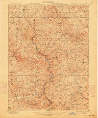
~ Parkton MD topo map, 1:62500 scale, 15 X 15 Minute, Historical, 1902, updated 1914
Parkton, Maryland, USGS topographic map dated 1902.
Includes geographic coordinates (latitude and longitude). This topographic map is suitable for hiking, camping, and exploring, or framing it as a wall map.
Printed on-demand using high resolution imagery, on heavy weight and acid free paper, or alternatively on a variety of synthetic materials.
Topos available on paper, Waterproof, Poly, or Tyvek. Usually shipping rolled, unless combined with other folded maps in one order.
- Product Number: USGS-5368418
- Free digital map download (high-resolution, GeoPDF): Parkton, Maryland (file size: 10 MB)
- Map Size: please refer to the dimensions of the GeoPDF map above
- Weight (paper map): ca. 55 grams
- Map Type: POD USGS Topographic Map
- Map Series: HTMC
- Map Verison: Historical
- Cell ID: 60773
- Scan ID: 257583
- Imprint Year: 1914
- Survey Year: 1900
- Datum: Unstated
- Map Projection: Unstated
- Map published by United States Geological Survey
- Map Language: English
- Scanner Resolution: 600 dpi
- Map Cell Name: Parkton
- Grid size: 15 X 15 Minute
- Date on map: 1902
- Map Scale: 1:62500
- Geographical region: Maryland, United States
Neighboring Maps:
All neighboring USGS topo maps are available for sale online at a variety of scales.
Spatial coverage:
Topo map Parkton, Maryland, covers the geographical area associated the following places:
- Pen Delle Manor - Walnut Springs - Manor Ridge - Jordan Mill Farms - Maplehurst Woods - Cloverfield - Chesterfield - Norrisville - Foxwood - North Green Ridge - Shawsville - Sweet Air Manor - Hamlet Farms - Bentley Estates - Coachmans Field - Old York Manor - Blue Mount - Trump - Shepperd - Meadow Stream - Farmington - Hereford - Carea - Holiday Hills - Evna - Wiseburg - The Highlands of Hunt Valley - Friends View - Amos Mill - Worthington Manor - Houcks Mill - Cross Creek - New Freedom - Retreat Farms - Stablers Manor - Arden Valley - Indian Meadows - Shane Valley - Madonna Manor - Drybranch - Corbett Hill Farms - Blackhorse - Greencroft - Hunt Crest - Taylor - Fox Meadows - Ross Valley Farms - Mount Carmel - Glencoe - Gorsuch Mills - Quinn - Stockton - Western Run - Monkton Farms - Patchwork Farms - Stablersville - Pine Hill Farms - Jacksonville - Fairwood of Hunt Valley - Dairy Manor Farms - Rolling Knolls - Parkton - Cooperfield - Piney Creek - Thompson Estates - Sharretts Ridge - Bentley Hills - Sparks - Shawsville Acres - Indian Hills - Blenheim Forest - Rayville - Manor - Grimesville - Oakland - Stringtown - Phoenix - Madonna - White Hall - Walker Manor - Green Meadow - Five Forks - Brook Valley Farms - Oaks of Parsonage - Bradenbaugh - Hunters Mill - Keeney Mill Woods - Manor View Farms - Harris Hill - Verona - Gores Mill - Loveton Farms - Bacon Hall - Ascot Estates - Bradenbaugh Manor - The Fields of Four Corners - Gillcrest - Locust Hill - Glen Elyn - My Ladys Manor Estates
- Map Area ID: AREA39.7539.5-76.75-76.5
- Northwest corner Lat/Long code: USGSNW39.75-76.75
- Northeast corner Lat/Long code: USGSNE39.75-76.5
- Southwest corner Lat/Long code: USGSSW39.5-76.75
- Southeast corner Lat/Long code: USGSSE39.5-76.5
- Northern map edge Latitude: 39.75
- Southern map edge Latitude: 39.5
- Western map edge Longitude: -76.75
- Eastern map edge Longitude: -76.5


