
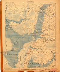
~ Nanticoke MD topo map, 1:62500 scale, 15 X 15 Minute, Historical, 1903
Nanticoke, Maryland, USGS topographic map dated 1903.
Includes geographic coordinates (latitude and longitude). This topographic map is suitable for hiking, camping, and exploring, or framing it as a wall map.
Printed on-demand using high resolution imagery, on heavy weight and acid free paper, or alternatively on a variety of synthetic materials.
Topos available on paper, Waterproof, Poly, or Tyvek. Usually shipping rolled, unless combined with other folded maps in one order.
- Product Number: USGS-5368346
- Free digital map download (high-resolution, GeoPDF): Nanticoke, Maryland (file size: 9 MB)
- Map Size: please refer to the dimensions of the GeoPDF map above
- Weight (paper map): ca. 55 grams
- Map Type: POD USGS Topographic Map
- Map Series: HTMC
- Map Verison: Historical
- Cell ID: 58264
- Scan ID: 257538
- Survey Year: 1902
- Datum: Unstated
- Map Projection: Unstated
- Map published by United States Geological Survey
- Map Language: English
- Scanner Resolution: 600 dpi
- Map Cell Name: Nanticoke
- Grid size: 15 X 15 Minute
- Date on map: 1903
- Map Scale: 1:62500
- Geographical region: Maryland, United States
Neighboring Maps:
All neighboring USGS topo maps are available for sale online at a variety of scales.
Spatial coverage:
Topo map Nanticoke, Maryland, covers the geographical area associated the following places:
- Tyaskin - Green Hill Village - Butlers Beach - Rewastico - Cokeland - Brick House Landing - Capitola - Deep Branch - Oak Terrace Trailer Park - Widgeon - Hollands Crossroads - Henrys Crossroads - Cherry Walk Estates - Coxs Corner - Jenkins Landing - Cedar Landing - Bestpitch - Elliott - Clara - Bivalve - Twin River Trailer Park - Nanticoke Acres - Lewis Landing - Vienna - Rocky Hook - Rabbit Town - Green Hill - Mardela Springs - Jesterville - Gum Swamp - Royal Oak - Westmoreland Park - Wetipquin - Martins Corner - Briar Patch - Spring Grove - Tyaskin Estates - Athol - Whitehaven - Nanticoke - New Road Landing
- Map Area ID: AREA38.538.25-76-75.75
- Northwest corner Lat/Long code: USGSNW38.5-76
- Northeast corner Lat/Long code: USGSNE38.5-75.75
- Southwest corner Lat/Long code: USGSSW38.25-76
- Southeast corner Lat/Long code: USGSSE38.25-75.75
- Northern map edge Latitude: 38.5
- Southern map edge Latitude: 38.25
- Western map edge Longitude: -76
- Eastern map edge Longitude: -75.75


