
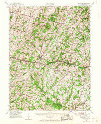
~ Mount Airy MD topo map, 1:62500 scale, 15 X 15 Minute, Historical, 1945, updated 1968
Mount Airy, Maryland, USGS topographic map dated 1945.
Includes geographic coordinates (latitude and longitude). This topographic map is suitable for hiking, camping, and exploring, or framing it as a wall map.
Printed on-demand using high resolution imagery, on heavy weight and acid free paper, or alternatively on a variety of synthetic materials.
Topos available on paper, Waterproof, Poly, or Tyvek. Usually shipping rolled, unless combined with other folded maps in one order.
- Product Number: USGS-5368336
- Free digital map download (high-resolution, GeoPDF): Mount Airy, Maryland (file size: 11 MB)
- Map Size: please refer to the dimensions of the GeoPDF map above
- Weight (paper map): ca. 55 grams
- Map Type: POD USGS Topographic Map
- Map Series: HTMC
- Map Verison: Historical
- Cell ID: 57931
- Scan ID: 257529
- Imprint Year: 1968
- Woodland Tint: Yes
- Aerial Photo Year: 1943
- Field Check Year: 1945
- Datum: NAD27
- Map Projection: Polyconic
- Map published by United States Geological Survey
- Map published by United States Army Corps of Engineers
- Map published by United States Army
- Map Language: English
- Scanner Resolution: 600 dpi
- Map Cell Name: Mount Airy
- Grid size: 15 X 15 Minute
- Date on map: 1945
- Map Scale: 1:62500
- Geographical region: Maryland, United States
Neighboring Maps:
All neighboring USGS topo maps are available for sale online at a variety of scales.
Spatial coverage:
Topo map Mount Airy, Maryland, covers the geographical area associated the following places:
- Watersville Acres - Rising Ridge - Cedar Heights Estates - Damascus Valley Park - Stonelake - Oak Orchard - Cumorah Estates - Bicentennial Estates - Robindell Heights - Woodville - Friendship - Jacobs Run - Ray-Mar Estates - Damascus - Darby Delight - Academy Acres - Gallagher Estates - Silver Crest - Matherwood Heights - Bartholows - South Glen - Four County Farm - Franklinville - Potomac Estates - Liberty Knolls - Mountain Vista - Roxbury Mills - Timberleigh Village - Hawthorne Acres - Sundown Manor - Braddock Manor West - Rosswood Estates - Legos Choice - Heritage - Ivy Hill Way - Warfield Estates - Vicky Estates - Mount Lebanon - Damascus Manor - Davis - Pheasant Ridge Estates - Lisbon Manor - Ridgewood Estates - Latigo Trails - Harrisville Farmettes - Daisy Meadows - Hungerford Manor - Skyline Manor - Airy Estates - Winfield - Montclare - Buffalo Estates - County View - Stanton Heights - Poulsen Heights - The Heritage - Lisbon - Fleming Way Estates - Heather Ridge - Purdum - Covers Corner - Oceola Estates - Daisy Meadows - Fox Ridge Estates - Park Lake Estates - Bloom - Nursery View - Rattle Ridge - Browningsville - Flag Marsh Heights - Kemptown - Quail Creek Acres - Roxbury - Cover (historical) - Woodville Meadows - Rainbow Estates - Inwood - Gary - Flowerwood Estates - Glenwood - Picketts Corner - Sun Valley - New Estates - Conestoga Heights - Woodville Terrace - Gillis Falls Estates - Dill - Linganore Woods - Belmar Estates - Candice Estates - Stoney Ridge - Jaycox - Kabik Korner - East Rolling Hills - Stone House Village - Florence Farms - Damascus Gardens - Oldfield - River Wood Hills - Mount Airy Estates
- Map Area ID: AREA39.539.25-77.25-77
- Northwest corner Lat/Long code: USGSNW39.5-77.25
- Northeast corner Lat/Long code: USGSNE39.5-77
- Southwest corner Lat/Long code: USGSSW39.25-77.25
- Southeast corner Lat/Long code: USGSSE39.25-77
- Northern map edge Latitude: 39.5
- Southern map edge Latitude: 39.25
- Western map edge Longitude: -77.25
- Eastern map edge Longitude: -77


