
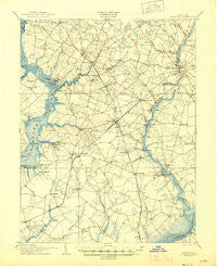
~ Hurlock MD topo map, 1:62500 scale, 15 X 15 Minute, Historical, 1905, updated 1945
Hurlock, Maryland, USGS topographic map dated 1905.
Includes geographic coordinates (latitude and longitude). This topographic map is suitable for hiking, camping, and exploring, or framing it as a wall map.
Printed on-demand using high resolution imagery, on heavy weight and acid free paper, or alternatively on a variety of synthetic materials.
Topos available on paper, Waterproof, Poly, or Tyvek. Usually shipping rolled, unless combined with other folded maps in one order.
- Product Number: USGS-5368252
- Free digital map download (high-resolution, GeoPDF): Hurlock, Maryland (file size: 7 MB)
- Map Size: please refer to the dimensions of the GeoPDF map above
- Weight (paper map): ca. 55 grams
- Map Type: POD USGS Topographic Map
- Map Series: HTMC
- Map Verison: Historical
- Cell ID: 55609
- Scan ID: 257480
- Imprint Year: 1945
- Survey Year: 1904
- Datum: Unstated
- Map Projection: Polyconic
- Map published by United States Geological Survey
- Map Language: English
- Scanner Resolution: 600 dpi
- Map Cell Name: Hurlock
- Grid size: 15 X 15 Minute
- Date on map: 1905
- Map Scale: 1:62500
- Geographical region: Maryland, United States
Neighboring Maps:
All neighboring USGS topo maps are available for sale online at a variety of scales.
Spatial coverage:
Topo map Hurlock, Maryland, covers the geographical area associated the following places:
- Rhodesdale - Southside Trailer Park - Salem - Grove - East New Market - Lloyd Landing - Windyhill - Ennalls (historical) - Airey - Choptank - Piney Grove Estates - Prospect Hills - Hubbard - Tanyard Estates - Brookview - Waddells Corner - Browns Landing - Marshyhope Village - West View - Ellwood - Beulah - Hynson - Linkwood - Hurlock - Eldorado - Federalsburg - Reids Grove - Nelpine Mobile Home Park - Shufelt - Bradley Heights - Sandtop - Prettyman Manor - Riverton - Walnut Landing - Jonestown - White Oak Manor - Petersburg - Linchester - Hawkeye - West Haven - Bethlehem - Hicksburg - Bruceville - Gluckheim (historical) - Meadowbrook Park - Shiloh Church - Wrights Wharf - Tilghman Mobile Home Park - Beaver Run Mobile Home Park - Holly Hill - Williamsburg - Cabin Creek Estates - Belmont Acres - Heritage Mobile Home Park - Secretary - Everlea - Preston - Shiloh Manor - Woodland Acres - Ralph - Meadowbrook Court - Thompsontown - Nichols - Finchville - Federalsburg Estates
- Map Area ID: AREA38.7538.5-76-75.75
- Northwest corner Lat/Long code: USGSNW38.75-76
- Northeast corner Lat/Long code: USGSNE38.75-75.75
- Southwest corner Lat/Long code: USGSSW38.5-76
- Southeast corner Lat/Long code: USGSSE38.5-75.75
- Northern map edge Latitude: 38.75
- Southern map edge Latitude: 38.5
- Western map edge Longitude: -76
- Eastern map edge Longitude: -75.75


