
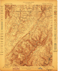
~ Grantsville MD topo map, 1:62500 scale, 15 X 15 Minute, Historical, 1899
Grantsville, Maryland, USGS topographic map dated 1899.
Includes geographic coordinates (latitude and longitude). This topographic map is suitable for hiking, camping, and exploring, or framing it as a wall map.
Printed on-demand using high resolution imagery, on heavy weight and acid free paper, or alternatively on a variety of synthetic materials.
Topos available on paper, Waterproof, Poly, or Tyvek. Usually shipping rolled, unless combined with other folded maps in one order.
- Product Number: USGS-5368170
- Free digital map download (high-resolution, GeoPDF): Grantsville, Maryland (file size: 12 MB)
- Map Size: please refer to the dimensions of the GeoPDF map above
- Weight (paper map): ca. 55 grams
- Map Type: POD USGS Topographic Map
- Map Series: HTMC
- Map Verison: Historical
- Cell ID: 54783
- Scan ID: 257420
- Survey Year: 1898
- Datum: Unstated
- Map Projection: Unstated
- Map published by United States Geological Survey
- Map Language: English
- Scanner Resolution: 600 dpi
- Map Cell Name: Grantsville
- Grid size: 15 X 15 Minute
- Date on map: 1899
- Map Scale: 1:62500
- Geographical region: Maryland, United States
Neighboring Maps:
All neighboring USGS topo maps are available for sale online at a variety of scales.
Spatial coverage:
Topo map Grantsville, Maryland, covers the geographical area associated the following places:
- Gannon - Niverton - Avilton - Phoenix (historical) - Piney Grove - Jennings - Foxtown - Bittinger - Fairview - Bevansville - Hi-Point - Sylvan Lane - High Point - Reynolds - Grantsville - Floyd - Springs - Dogwood Flats - North Glade - New Germany - Casselman - Barton - Moscow - Merrill
- Map Area ID: AREA39.7539.5-79.25-79
- Northwest corner Lat/Long code: USGSNW39.75-79.25
- Northeast corner Lat/Long code: USGSNE39.75-79
- Southwest corner Lat/Long code: USGSSW39.5-79.25
- Southeast corner Lat/Long code: USGSSE39.5-79
- Northern map edge Latitude: 39.75
- Southern map edge Latitude: 39.5
- Western map edge Longitude: -79.25
- Eastern map edge Longitude: -79


