
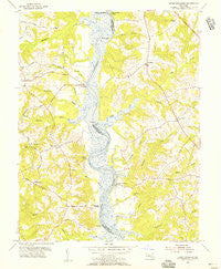
~ Lower Marlboro MD topo map, 1:24000 scale, 7.5 X 7.5 Minute, Historical, 1953, updated 1956
Lower Marlboro, Maryland, USGS topographic map dated 1953.
Includes geographic coordinates (latitude and longitude). This topographic map is suitable for hiking, camping, and exploring, or framing it as a wall map.
Printed on-demand using high resolution imagery, on heavy weight and acid free paper, or alternatively on a variety of synthetic materials.
Topos available on paper, Waterproof, Poly, or Tyvek. Usually shipping rolled, unless combined with other folded maps in one order.
- Product Number: USGS-5366680
- Free digital map download (high-resolution, GeoPDF): Lower Marlboro, Maryland (file size: 11 MB)
- Map Size: please refer to the dimensions of the GeoPDF map above
- Weight (paper map): ca. 55 grams
- Map Type: POD USGS Topographic Map
- Map Series: HTMC
- Map Verison: Historical
- Cell ID: 70756
- Scan ID: 256552
- Imprint Year: 1956
- Woodland Tint: Yes
- Aerial Photo Year: 1953
- Edit Year: 1953
- Survey Year: 1935
- Datum: NAD27
- Map Projection: Polyconic
- Map published by United States Geological Survey
- Map Language: English
- Scanner Resolution: 600 dpi
- Map Cell Name: Lower Marlboro
- Grid size: 7.5 X 7.5 Minute
- Date on map: 1953
- Map Scale: 1:24000
- Geographical region: Maryland, United States
Neighboring Maps:
All neighboring USGS topo maps are available for sale online at a variety of scales.
Spatial coverage:
Topo map Lower Marlboro, Maryland, covers the geographical area associated the following places:
- Briarwood - Meadow Run Park - Stone Farm - MacDonald Farms - Lower Marlboro Towne - White Landing - Halls Hills - Smoky - Welchpoole Estates - Woodlawn Farms - Hampton Heights - Calvert Chase - Circles Trailer Park - Academy Hill - Lakewood Estates - Dunkirk South - Field Acres - Crow Haven Estates - Dunkirk Fields - South Hampton - Odyssey - Century Estates - Laurian - Ashwood Manor - Fox Hunt Estates - Naylor - Lower Marlboro - Kings Landing - Magruder Landing - Lord Calvert Estates - Wilson (historical) - Dunkirk Woods - Owensville - Bald Eagle - Musgrove Estates - Country Road Estates - The Meadows - Mount Harmony Hills - Huntingtown Farms - Brooks View - Ferguson - Cedar Run - Sunshine Acres - Chaneyville - Chaneyville Farm Estates - Patuxent Highland (historical) - Cedarwood - Howes Meadows - Breezy Knoll Estates - Bright Acres Mobile Home Park - Castlemore - Mill Branch Estates - Smithville - Patuxent Palisades - Milltown Landing - Calvert Manor - Mount Harmony Estates - Ferry Landing Woods - Mill Seat - Crestwood - Foxchase - Penwick Village - Cavalier Country - Bowling Landing - Regal Estastes - Westwood - Dunkirk - Shores of Calvert - Regency Manor Mobile Home Park - Arbor Greene - Wards Meadow - Dunkirk Hall - Sunderland Woods - Apple Greene - Somerset
- Map Area ID: AREA38.7538.625-76.75-76.625
- Northwest corner Lat/Long code: USGSNW38.75-76.75
- Northeast corner Lat/Long code: USGSNE38.75-76.625
- Southwest corner Lat/Long code: USGSSW38.625-76.75
- Southeast corner Lat/Long code: USGSSE38.625-76.625
- Northern map edge Latitude: 38.75
- Southern map edge Latitude: 38.625
- Western map edge Longitude: -76.75
- Eastern map edge Longitude: -76.625


