
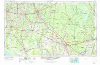
~ Valdosta GA topo map, 1:250000 scale, 1 X 2 Degree, Historical, 1954, updated 1967
Valdosta, Georgia, USGS topographic map dated 1954.
Includes geographic coordinates (latitude and longitude). This topographic map is suitable for hiking, camping, and exploring, or framing it as a wall map.
Printed on-demand using high resolution imagery, on heavy weight and acid free paper, or alternatively on a variety of synthetic materials.
Topos available on paper, Waterproof, Poly, or Tyvek. Usually shipping rolled, unless combined with other folded maps in one order.
- Product Number: USGS-5365402
- Free digital map download (high-resolution, GeoPDF): Valdosta, Georgia (file size: 17 MB)
- Map Size: please refer to the dimensions of the GeoPDF map above
- Weight (paper map): ca. 55 grams
- Map Type: POD USGS Topographic Map
- Map Series: HTMC
- Map Verison: Historical
- Cell ID: 69079
- Scan ID: 247855
- Imprint Year: 1967
- Woodland Tint: Yes
- Visual Version Number: 2
- Aerial Photo Year: 1951
- Edit Year: 1965
- Field Check Year: 1954
- Datum: Unstated
- Map Projection: Transverse Mercator
- Map published by United States Geological Survey
- Map Language: English
- Scanner Resolution: 600 dpi
- Map Cell Name: Valdosta
- Grid size: 1 X 2 Degree
- Date on map: 1954
- Map Scale: 1:250000
- Geographical region: Georgia, United States
Neighboring Maps:
All neighboring USGS topo maps are available for sale online at a variety of scales.
Spatial coverage:
Topo map Valdosta, Georgia, covers the geographical area associated the following places:
- Hopewell - Wilburn - Bailey - Boston - Highland Heights - Fruitland - Chauncey - Everetts Mobile Home Park - Midway - Perry - Seaford (historical) - Maines Devoe Mobile Home Park - Kinderlou - Magnolia - Potter - Silver Hill - Eastwind - Pidcock - Twin Lakes - Ernest - Padlock - Myrtis - Hilltop Mobile Home Park - Lawton - Eason - Drifton - Belmont - Cabbage Grove - Lee and Baker Mobile Home Park 2 - West Pines Village Mobile Home Park - Kenny - McLeods Mill - Greens Crossing - Roach - Beverly (historical) - Mason - Lakeview Heights - Nutall Rise - McIntyre Spring (historical) - Homeland - Toledo - Wellborn - Eddy - Pine Top - Nash - Atawalia (historical) - Spain - Bass - Miltons Campground Number 1 - Clyattville - Old Clyattville - Highland - Pebble Hill - Woodgate - Needmore - Spray - San Pedro Junction - Sirmans - Cypress Pointe Mobile Home Park - Nugalla (historical) - Mayo Junction - San Luis Apalache (historical) - Mattox - Jasper - Sanderson - Live Oak - Cliftonville - Hamaste (historical) - Willanocha (historical) - Fincher - Heilbronn - Blacks Still - Ellerbee - Providence - Nankin - Iddo - Cypress Creek - Jennings - Cherokee Plantation - Stephenton (historical) - Deer Run Mobile Home Park - Jackson - Covington - Eridu - Herring - Hopeful Circle Village Mobile Home Park - Shiloh - Pineland - Mandalay - Five Points - Stern - Jamestown - Holmes Trailer Park - Econfina - Dewey City - Hopkins - Maxville - Eager - Monticello - Waukeenah
- Map Area ID: AREA3130-84-82
- Northwest corner Lat/Long code: USGSNW31-84
- Northeast corner Lat/Long code: USGSNE31-82
- Southwest corner Lat/Long code: USGSSW30-84
- Southeast corner Lat/Long code: USGSSE30-82
- Northern map edge Latitude: 31
- Southern map edge Latitude: 30
- Western map edge Longitude: -84
- Eastern map edge Longitude: -82


