
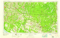
~ Valdosta GA topo map, 1:250000 scale, 1 X 2 Degree, Historical, 1959
Valdosta, Georgia, USGS topographic map dated 1959.
Includes geographic coordinates (latitude and longitude). This topographic map is suitable for hiking, camping, and exploring, or framing it as a wall map.
Printed on-demand using high resolution imagery, on heavy weight and acid free paper, or alternatively on a variety of synthetic materials.
Topos available on paper, Waterproof, Poly, or Tyvek. Usually shipping rolled, unless combined with other folded maps in one order.
- Product Number: USGS-5365398
- Free digital map download (high-resolution, GeoPDF): Valdosta, Georgia (file size: 17 MB)
- Map Size: please refer to the dimensions of the GeoPDF map above
- Weight (paper map): ca. 55 grams
- Map Type: POD USGS Topographic Map
- Map Series: HTMC
- Map Verison: Historical
- Cell ID: 69079
- Scan ID: 247853
- Woodland Tint: Yes
- Aerial Photo Year: 1951
- Field Check Year: 1954
- Datum: Unstated
- Map Projection: Transverse Mercator
- Map published by United States Geological Survey
- Map Language: English
- Scanner Resolution: 600 dpi
- Map Cell Name: Valdosta
- Grid size: 1 X 2 Degree
- Date on map: 1959
- Map Scale: 1:250000
- Geographical region: Georgia, United States
Neighboring Maps:
All neighboring USGS topo maps are available for sale online at a variety of scales.
Spatial coverage:
Topo map Valdosta, Georgia, covers the geographical area associated the following places:
- Wellborn - Pleasant View Mobile Home Park - Newell - Etotulga (historical) - Nash - Hollis - Atawalia (historical) - Woodgate - Forrestwood Estates - Folkston - Blue Springs - Joree Springs - Rixford - Pine Mount - Secotan - Antioch (historical) - Falmouth - Winfield - Lawton - Magnolia - Hanson - Shelly - Chapman (historical) - Hallmark Heights - Benton - Chauncey - Rawls - Clarking - Eason - Pinland - Hilltop Mobile Home Park - San Francisco de Oconi (historical) - Lincoln Park - Tillman (historical) - Ebenezer - San Juan de Guacara (historical) - Roach - Fort Union - Newco - Bemiss - Mobile Home Estates - Avoca - Johnstown - Maines Devoe Mobile Home Park - Padlock - Booker Heights - Lee - Vickers Crossing - Olustee - McLoughlin Heights - Forrest Place - San Pedro Junction - Dillon - Steckert - Fruitland - Fenholloway - Ellisville - Twin Lakes - Willanocha (historical) - Greens Crossing - Franklinville - Lee and Baker Mobile Home Park 2 - Lakeland Forest - Alton - Monticello - Macclenny - Mikasuki (historical) - Mason - Covington - Wood Valley - Cliftonville - Hatchcakamocha (historical) - Needmore - Greenville - Ferry Landing - Mederer Acres - Midway - Buckville - Boggy - Okeafenoke Swamp (historical) - Spray - Fourth Street Trailer Park - Mattox - Potter - Marion - Suwannee - Cypress Pointe Mobile Home Park - North Gate Manor Trailer Park - Olympia (historical) - Withers - Hillcoat - Midway - Trailer Harbor Mobile Home Park - Traders Hill - Remerton - Foxborough - Luraville - Ahosulga (historical) - Kennedy Still - Waylonzo
- Map Area ID: AREA3130-84-82
- Northwest corner Lat/Long code: USGSNW31-84
- Northeast corner Lat/Long code: USGSNE31-82
- Southwest corner Lat/Long code: USGSSW30-84
- Southeast corner Lat/Long code: USGSSE30-82
- Northern map edge Latitude: 31
- Southern map edge Latitude: 30
- Western map edge Longitude: -84
- Eastern map edge Longitude: -82


