
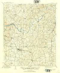
~ Acworth GA topo map, 1:62500 scale, 15 X 15 Minute, Historical, 1907, updated 1954
Acworth, Georgia, USGS topographic map dated 1907.
Includes geographic coordinates (latitude and longitude). This topographic map is suitable for hiking, camping, and exploring, or framing it as a wall map.
Printed on-demand using high resolution imagery, on heavy weight and acid free paper, or alternatively on a variety of synthetic materials.
Topos available on paper, Waterproof, Poly, or Tyvek. Usually shipping rolled, unless combined with other folded maps in one order.
- Product Number: USGS-5364644
- Free digital map download (high-resolution, GeoPDF): Acworth, Georgia (file size: 8 MB)
- Map Size: please refer to the dimensions of the GeoPDF map above
- Weight (paper map): ca. 55 grams
- Map Type: POD USGS Topographic Map
- Map Series: HTMC
- Map Verison: Historical
- Cell ID: 50306
- Scan ID: 247326
- Imprint Year: 1954
- Datum: NAD27
- Map Projection: Polyconic
- Map published by United States Geological Survey
- Map Language: English
- Scanner Resolution: 600 dpi
- Map Cell Name: Acwdrtii
- Grid size: 15 X 15 Minute
- Date on map: 1907
- Map Scale: 1:62500
- Geographical region: Georgia, United States
Neighboring Maps:
All neighboring USGS topo maps are available for sale online at a variety of scales.
Spatial coverage:
Topo map Acworth, Georgia, covers the geographical area associated the following places:
- Mars Hill - Kingridge Estates - Kings Crossing - Yacht Club Estates - Bascombs Springs - Glenell - Stockwood Estates - Oak Grove Estates - McCollum Acres - Mitchell Hill - Mars Hill Acres - Giles Crossing - Homestead Acres - Blackwell Chase - Lakeside Hills - Acworth - Woodstock - Brookwood Estates - Edgewood Estates - Eastgate Mobile Home Park - Green Hills Estates - Nowlin Estates - Skyridge - Iron Hill - Arden Lake - Emerald Forest - Lake Manor - Hunt Club - Little River Landing - Valley Hill Estates - Woodwind Station - Deerfield - Cross Creek - Land of Lakes - Indian Valley Estates - North Bridge Trace - Stir Up Manor - Kellogg Creek - Powell Station - Victoria - Pine Valley Farms - Pinehurst - Allatoona - Etheridge Glen - Picketts Plantation - Cherokee Estates - Harris Woods - Cedar Mill Crossing - Chestnut Hill - Davenport Trace - Motes Hill - Shallowford Forest - Cherokee South - Dobbs Estates - Laurel Hills - Southfork - Spring Valley Mobile Home Park - Bartow - Heritage Farms - Twin Pines - The Woodlands - Timberlake North - Bells Ferry Place - Plantation Walk - Village Green - Picketts Mill - Sherwood Forest - Oak Creek Estates - Kennesaw - Shadowbrook - Logan Trace - Lansdowne - Jarratt Crossing - Cherokee - Sutallee - Nowlin Station - Lakeview Heights - Gibson Acres - Countryside Estates - Acworth Meadows - Hills-A-Rolling - Kingridge West - Allatoona Beach - East Boxwood Estates - Emerald Willows - Falcon Shores - Cardinal Woods - Falcon Hills - Cobb Place Manor - Picketts Crossing - Hickory Forest - Acworth Beach - Greyfield North - Pine Hill - Lebanon - Pages Mobile Home Park - Sturbridge - Laffingal - Hill Forest Estates - Allatoona Ridge
- Map Area ID: AREA34.2534-84.75-84.5
- Northwest corner Lat/Long code: USGSNW34.25-84.75
- Northeast corner Lat/Long code: USGSNE34.25-84.5
- Southwest corner Lat/Long code: USGSSW34-84.75
- Southeast corner Lat/Long code: USGSSE34-84.5
- Northern map edge Latitude: 34.25
- Southern map edge Latitude: 34
- Western map edge Longitude: -84.75
- Eastern map edge Longitude: -84.5


