
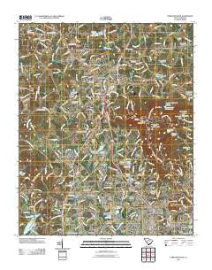
~ Paris Mountain SC topo map, 1:24000 scale, 7.5 X 7.5 Minute, Historical, 2011
Paris Mountain, South Carolina, USGS topographic map dated 2011.
Includes geographic coordinates (latitude and longitude). This topographic map is suitable for hiking, camping, and exploring, or framing it as a wall map.
Printed on-demand using high resolution imagery, on heavy weight and acid free paper, or alternatively on a variety of synthetic materials.
Topos available on paper, Waterproof, Poly, or Tyvek. Usually shipping rolled, unless combined with other folded maps in one order.
- Product Number: USGS-5360145
- Free digital map download (high-resolution, GeoPDF): Paris Mountain, South Carolina (file size: 25 MB)
- Map Size: please refer to the dimensions of the GeoPDF map above
- Weight (paper map): ca. 55 grams
- Map Type: POD USGS Topographic Map
- Map Series: US Topo
- Map Verison: Historical
- Cell ID: 34199
- Datum: North American Datum of 1983
- Map Projection: Transverse Mercator
- Map Cell Name: Paris Mountain
- Grid size: 7.5 X 7.5 Minute
- Date on map: 2011
- Map Scale: 1:24000
- Geographical region: South Carolina, United States
Neighboring Maps:
All neighboring USGS topo maps are available for sale online at a variety of scales.
Spatial coverage:
Topo map Paris Mountain, South Carolina, covers the geographical area associated the following places:
- Richmond Hills - Parkstone - Cedar Lane Gardens - Northwood Hills - Cope Heights - Pinehurst - Berea Forest - Dellhaven - Little Texas - Sunny Acres - Mountain Shadows - Indian Hills - Northgate - Renfrew - Leawood - Paris Point - Berea Heights - Brookgreen - Hillandale - Montague - Sans Souci Heights - Sunny Slopes - Sharon Park - Stratford Forest - New Furman Heights - High View Acres - Western Hills - Travelers Rest - Starsdale Manor - Sans Souci - Berea - Points North - Buxton - Colonial Oaks Mobile Manor - Oak Hills
- Map Area ID: AREA3534.875-82.5-82.375
- Northwest corner Lat/Long code: USGSNW35-82.5
- Northeast corner Lat/Long code: USGSNE35-82.375
- Southwest corner Lat/Long code: USGSSW34.875-82.5
- Southeast corner Lat/Long code: USGSSE34.875-82.375
- Northern map edge Latitude: 35
- Southern map edge Latitude: 34.875
- Western map edge Longitude: -82.5
- Eastern map edge Longitude: -82.375


