
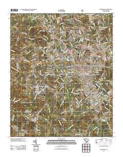
~ Greenwood SC topo map, 1:24000 scale, 7.5 X 7.5 Minute, Historical, 2011
Greenwood, South Carolina, USGS topographic map dated 2011.
Includes geographic coordinates (latitude and longitude). This topographic map is suitable for hiking, camping, and exploring, or framing it as a wall map.
Printed on-demand using high resolution imagery, on heavy weight and acid free paper, or alternatively on a variety of synthetic materials.
Topos available on paper, Waterproof, Poly, or Tyvek. Usually shipping rolled, unless combined with other folded maps in one order.
- Product Number: USGS-5360069
- Free digital map download (high-resolution, GeoPDF): Greenwood, South Carolina (file size: 26 MB)
- Map Size: please refer to the dimensions of the GeoPDF map above
- Weight (paper map): ca. 55 grams
- Map Type: POD USGS Topographic Map
- Map Series: US Topo
- Map Verison: Historical
- Cell ID: 18494
- Datum: North American Datum of 1983
- Map Projection: Transverse Mercator
- Map Cell Name: Greenwood
- Grid size: 7.5 X 7.5 Minute
- Date on map: 2011
- Map Scale: 1:24000
- Geographical region: South Carolina, United States
Neighboring Maps:
All neighboring USGS topo maps are available for sale online at a variety of scales.
Spatial coverage:
Topo map Greenwood, South Carolina, covers the geographical area associated the following places:
- Chinquapin - Edgemere - Kimbrook - Canterbury - Cedar Lake - Hill and Dale - Avondale - Grendel Village - Idlewood - Cherokee Hills - Timberlake - Breckridge - Ellenwood Acres - Highland Forest - Northfall Acres - Page Place - Locksley Hall - Greenwood - Stalnaker Heights - Crestview - Druid Hills - Westgate - Brookside - Mathews Heights - Panola Village - Belle Meade - Woodlawn - Salak - Bullock (historical) - Smithfield - Greenwood Village - Lorenzo (historical) - Pine Grove Hills - Wade Heights - Forest Lake - Blakedale - Lodge Grounds - Cothran (historical) - Augusta Fields - Windtree - Glendale - Forest Hills - Ponderosa Heights - Promised Land - Downs Siding - Westover - New Market - Rock Creek - Harris - Briarcliff - Fawn Brook - Wisewood - Dalewood - Hyde Park - Lakewood Heights - Mathews Village - South Greenwood - Sheffield - Wellington Green - McCombs
- Map Area ID: AREA34.2534.125-82.25-82.125
- Northwest corner Lat/Long code: USGSNW34.25-82.25
- Northeast corner Lat/Long code: USGSNE34.25-82.125
- Southwest corner Lat/Long code: USGSSW34.125-82.25
- Southeast corner Lat/Long code: USGSSE34.125-82.125
- Northern map edge Latitude: 34.25
- Southern map edge Latitude: 34.125
- Western map edge Longitude: -82.25
- Eastern map edge Longitude: -82.125


