
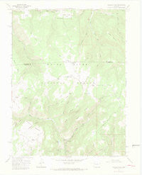
~ Triangle Park CO topo map, 1:24000 scale, 7.5 X 7.5 Minute, Historical, 1966, updated 1969
Triangle Park, Colorado, USGS topographic map dated 1966.
Includes geographic coordinates (latitude and longitude). This topographic map is suitable for hiking, camping, and exploring, or framing it as a wall map.
Printed on-demand using high resolution imagery, on heavy weight and acid free paper, or alternatively on a variety of synthetic materials.
Topos available on paper, Waterproof, Poly, or Tyvek. Usually shipping rolled, unless combined with other folded maps in one order.
- Product Number: USGS-5356971
- Free digital map download (high-resolution, GeoPDF): Triangle Park, Colorado (file size: 6 MB)
- Map Size: please refer to the dimensions of the GeoPDF map above
- Weight (paper map): ca. 55 grams
- Map Type: POD USGS Topographic Map
- Map Series: HTMC
- Map Verison: Historical
- Cell ID: 45654
- Scan ID: 402025
- Imprint Year: 1969
- Woodland Tint: Yes
- Visual Version Number: 1
- Aerial Photo Year: 1965
- Field Check Year: 1966
- Datum: NAD27
- Map Projection: Polyconic
- Map published by United States Geological Survey
- Map Language: English
- Scanner Resolution: 508 dpi
- Map Cell Name: Triangle Park
- Grid size: 7.5 X 7.5 Minute
- Date on map: 1966
- Map Scale: 1:24000
- Geographical region: Colorado, United States
Neighboring Maps:
All neighboring USGS topo maps are available for sale online at a variety of scales.
Spatial coverage:
Topo map Triangle Park, Colorado, covers the geographical area associated the following places:
- Snowdrift Mountain - Irish Spring - Tangle Gulch - Salt Creek - Dynamite Lake - Orphan Spring - Dutch Creek - Trappers Gulch - Mud Spring - Middle Fork North Elk Creek - Corbett Lake - Little Hill - Little Box Canyon Campground - Spruce Picnic Area - Mud Spring Ranch - Wear Park - G V Creek - Hamilton Camp - Bear Gulch - Little Box Campground - Three Forks Creek - Lake Park - Irish Ridge - Seaman Park - Stump Gulch - Irish Gulch - Middle Mountain - Banner Ridge - Saddle Horse Park - Coulter Dam - Burnt Ridge - Prospect Draw - Twin Springs - Coulter Lake - Hoover Gulch - G V Spring - Widow Spring - West Fork North Elk Creek - Garden Gulch - East Fork North Elk Creek - Three Forks Campground - Little GV Spring - Triangle Park - Little Box Canyon
- Map Area ID: AREA39.87539.75-107.75-107.625
- Northwest corner Lat/Long code: USGSNW39.875-107.75
- Northeast corner Lat/Long code: USGSNE39.875-107.625
- Southwest corner Lat/Long code: USGSSW39.75-107.75
- Southeast corner Lat/Long code: USGSSE39.75-107.625
- Northern map edge Latitude: 39.875
- Southern map edge Latitude: 39.75
- Western map edge Longitude: -107.75
- Eastern map edge Longitude: -107.625


