
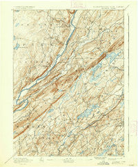
~ Wallpack PA topo map, 1:62500 scale, 15 X 15 Minute, Historical, 1893, updated 1937
Wallpack, Pennsylvania, USGS topographic map dated 1893.
Includes geographic coordinates (latitude and longitude). This topographic map is suitable for hiking, camping, and exploring, or framing it as a wall map.
Printed on-demand using high resolution imagery, on heavy weight and acid free paper, or alternatively on a variety of synthetic materials.
Topos available on paper, Waterproof, Poly, or Tyvek. Usually shipping rolled, unless combined with other folded maps in one order.
- Product Number: USGS-5331748
- Free digital map download (high-resolution, GeoPDF): Wallpack, Pennsylvania (file size: 9 MB)
- Map Size: please refer to the dimensions of the GeoPDF map above
- Weight (paper map): ca. 55 grams
- Map Type: POD USGS Topographic Map
- Map Series: HTMC
- Map Verison: Historical
- Cell ID: 53446
- Scan ID: 222358
- Imprint Year: 1937
- Survey Year: 1888
- Datum: Unstated
- Map Projection: Polyconic
- Map published by United States Geological Survey
- Map Language: English
- Scanner Resolution: 600 dpi
- Map Cell Name: Dingmans Ferry
- Grid size: 15 X 15 Minute
- Date on map: 1893
- Map Scale: 1:62500
- Geographical region: Pennsylvania, United States
Neighboring Maps:
All neighboring USGS topo maps are available for sale online at a variety of scales.
Spatial coverage:
Topo map Wallpack, Pennsylvania, covers the geographical area associated the following places:
- Fredon - Washingtonville - Mount Pisgah - Swartswood - Pocono Mountain Lake Estates - Delaware - Branchville - Millbrook - Flatbrookville - Wild Acres - Crandon Lakes - Middleville - Hardwick - Normanook - Pocono Mountain Lake Estates - Five Points - Newton - Wallpack Center - Balesville - Bevans - Hardwick Center - Stillwater - Culvers Inlet - Pine Ridge - Spring Valley - Myrtle Grove - Tuttles Corner - Layton - Egypt Mills - Haneys Mill - Pocono Ranch Lands - Springdale - Franklin Grove - Paulins Kill - Dingmans Ferry
- Map Area ID: AREA41.2541-75-74.75
- Northwest corner Lat/Long code: USGSNW41.25-75
- Northeast corner Lat/Long code: USGSNE41.25-74.75
- Southwest corner Lat/Long code: USGSSW41-75
- Southeast corner Lat/Long code: USGSSE41-74.75
- Northern map edge Latitude: 41.25
- Southern map edge Latitude: 41
- Western map edge Longitude: -75
- Eastern map edge Longitude: -74.75


