
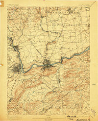
~ Allentown PA topo map, 1:62500 scale, 15 X 15 Minute, Historical, 1894, updated 1898
Allentown, Pennsylvania, USGS topographic map dated 1894.
Includes geographic coordinates (latitude and longitude). This topographic map is suitable for hiking, camping, and exploring, or framing it as a wall map.
Printed on-demand using high resolution imagery, on heavy weight and acid free paper, or alternatively on a variety of synthetic materials.
Topos available on paper, Waterproof, Poly, or Tyvek. Usually shipping rolled, unless combined with other folded maps in one order.
- Product Number: USGS-5329294
- Free digital map download (high-resolution, GeoPDF): Allentown, Pennsylvania (file size: 8 MB)
- Map Size: please refer to the dimensions of the GeoPDF map above
- Weight (paper map): ca. 55 grams
- Map Type: POD USGS Topographic Map
- Map Series: HTMC
- Map Verison: Historical
- Cell ID: 50440
- Scan ID: 169766
- Imprint Year: 1898
- Survey Year: 1893
- Datum: Unstated
- Map Projection: Unstated
- Map published by United States Geological Survey
- Map Language: English
- Scanner Resolution: 600 dpi
- Map Cell Name: Allentown
- Grid size: 15 X 15 Minute
- Date on map: 1894
- Map Scale: 1:62500
- Geographical region: Pennsylvania, United States
Neighboring Maps:
All neighboring USGS topo maps are available for sale online at a variety of scales.
Spatial coverage:
Topo map Allentown, Pennsylvania, covers the geographical area associated the following places:
- Welagamika (historical) - Tatamy - Juniper Circle - Kreidersville - Old Orchard - Gauff Hill - Jamesville - Mickleys - Chickentown - Saucon - Nelighsville - Saucona - Hecktown - Bethlehem - Lincoln Terrace - Walters - Steel City - Newport - Newburg - Arlington Knolls - Nazareth - Fullerton - Leithsville - Wagnerville - Colesville - Farmington - Freemansburg - Newburg Homes - Allen Junction - Emmaus Junction - South Terrace - Polk Valley - Hollo - Marlin Hills - Stafore Estates - Coopersburg - Northwood Heights - Highland Park - Waldheim Park - Spring Valley - Franks Corner - Friedensville - William Penn Manor - Palmer Heights - Hanoverville - Star Village - Steuben - Vera Cruz Station - Saucon Valley - Northampton Heights - Delta Manor - Catasauqua - Fountain Hill - Midway Manor - New Centerville - Center Valley - Mount Hope - Jacksonville - Middletown - Lincoln Park - Rocky Valley - Emmaus - Hawktown - Notre Dame Hills - Ritterville - Brodhead - Allentown - Northampton - Hanover Acres - Hellertown - Overlook Springs - Miller Manor - Mountainville - North Catasauqua - Kirchberg - Seidersville - Schoenersville - Macada - Springtown - Bethlehem View - Shimersville - Coplay - Wilbur - Amity - Wydnor - Prospect Park - Alton Park - Butztown - Lanark - Bingen - East Hills - Lime Ridge - Gruversville - West Catasauqua - Altonah - Georgetown - Hokendauqua - Evergreen Park - Howertown - Vera Cruz
- Map Area ID: AREA40.7540.5-75.5-75.25
- Northwest corner Lat/Long code: USGSNW40.75-75.5
- Northeast corner Lat/Long code: USGSNE40.75-75.25
- Southwest corner Lat/Long code: USGSSW40.5-75.5
- Southeast corner Lat/Long code: USGSSE40.5-75.25
- Northern map edge Latitude: 40.75
- Southern map edge Latitude: 40.5
- Western map edge Longitude: -75.5
- Eastern map edge Longitude: -75.25


