
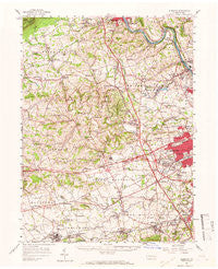
~ Alburtis PA topo map, 1:62500 scale, 15 X 15 Minute, Historical, 1957, updated 1966
Alburtis, Pennsylvania, USGS topographic map dated 1957.
Includes geographic coordinates (latitude and longitude). This topographic map is suitable for hiking, camping, and exploring, or framing it as a wall map.
Printed on-demand using high resolution imagery, on heavy weight and acid free paper, or alternatively on a variety of synthetic materials.
Topos available on paper, Waterproof, Poly, or Tyvek. Usually shipping rolled, unless combined with other folded maps in one order.
- Product Number: USGS-5329256
- Free digital map download (high-resolution, GeoPDF): Alburtis, Pennsylvania (file size: 9 MB)
- Map Size: please refer to the dimensions of the GeoPDF map above
- Weight (paper map): ca. 55 grams
- Map Type: POD USGS Topographic Map
- Map Series: HTMC
- Map Verison: Historical
- Cell ID: 50405
- Scan ID: 167910
- Imprint Year: 1966
- Woodland Tint: Yes
- Aerial Photo Year: 1957
- Field Check Year: 1957
- Datum: NAD27
- Map Projection: Polyconic
- Map published by United States Geological Survey
- Map Language: English
- Scanner Resolution: 600 dpi
- Map Cell Name: Alburtis
- Grid size: 15 X 15 Minute
- Date on map: 1957
- Map Scale: 1:62500
- Geographical region: Pennsylvania, United States
Neighboring Maps:
All neighboring USGS topo maps are available for sale online at a variety of scales.
Spatial coverage:
Topo map Alburtis, Pennsylvania, covers the geographical area associated the following places:
- Stiles - Schofer - Neffs - Trout Creek - Eckert (historical) - Weilersville - Schnecksville - Stetlersville - Jordan Valley - Shankweilers - Best Station - Bittners Corner - East Fogelsville - Leather Corner Post - Ormrod - Orefield - Farmington - Walnutport Acres - Cetronia - Williamstown - Germansville - Saegersville - North Fogelsville - Friedens - Scherersville - Seiberlingville - Seipstown - Greenawalds - Haafsville - Chapman - Laros (historical) - Wellington - Dorneyville - Park Way Manor - Ancient Oaks - Haines - Country View Mobile Home Park - Egypt - Guth - Mill Creek Corner - Oreville - Peters Store - Kuhnsville - Meyersville - Westwood Heights - Custer - Minesite - Walnut Acres - Helfrichsville - Ringtown - Hinterleiter - Diebertsville - Unionville - Newside - Macungie - River View - Newtown - Cedarbrook County Home - Hynemansville - Home Park - Monterey - Cementon - Metamora Station - Hillside - Lockport - Raubs Mills - Werleys Corner - Shamrock Station - Ruchsville - Switzer - Ruppsville - Hilltown - Balliettsville - New Smithville - Alburtis - Rockdale - North Coplay - Emerald - East Texas - Pleasant Corners - Maxatawny - Slatington - Treichlers - Wescosville - Weidasville - Guthsville - Klines Corner - Hancock - Mickleys Gardens - Claussville - Wallner (historical) - Topton - Weisenberg - Spring Creek - Litzenberg - Dewey Heights - Mechanicsville - Walbert - Sterlingworth - Slatedale
- Map Area ID: AREA40.7540.5-75.75-75.5
- Northwest corner Lat/Long code: USGSNW40.75-75.75
- Northeast corner Lat/Long code: USGSNE40.75-75.5
- Southwest corner Lat/Long code: USGSSW40.5-75.75
- Southeast corner Lat/Long code: USGSSE40.5-75.5
- Northern map edge Latitude: 40.75
- Southern map edge Latitude: 40.5
- Western map edge Longitude: -75.75
- Eastern map edge Longitude: -75.5


