
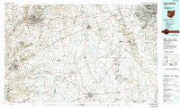
~ Springfield OH topo map, 1:100000 scale, 30 X 60 Minute, Historical, 1986, updated 1990
Springfield, Ohio, USGS topographic map dated 1986.
Includes geographic coordinates (latitude and longitude). This topographic map is suitable for hiking, camping, and exploring, or framing it as a wall map.
Printed on-demand using high resolution imagery, on heavy weight and acid free paper, or alternatively on a variety of synthetic materials.
Topos available on paper, Waterproof, Poly, or Tyvek. Usually shipping rolled, unless combined with other folded maps in one order.
- Product Number: USGS-5321540
- Free digital map download (high-resolution, GeoPDF): Springfield, Ohio (file size: 21 MB)
- Map Size: please refer to the dimensions of the GeoPDF map above
- Weight (paper map): ca. 55 grams
- Map Type: POD USGS Topographic Map
- Map Series: HTMC
- Map Verison: Historical
- Cell ID: 68403
- Scan ID: 228177
- Imprint Year: 1990
- Woodland Tint: Yes
- Photo Inspection Year: 1988
- Aerial Photo Year: 1988
- Edit Year: 1986
- Datum: NAD27
- Map Projection: Universal Transverse Mercator
- Map published by United States Geological Survey
- Map Language: English
- Scanner Resolution: 600 dpi
- Map Cell Name: Springfield
- Grid size: 30 X 60 Minute
- Date on map: 1986
- Map Scale: 1:100000
- Geographical region: Ohio, United States
Neighboring Maps:
All neighboring USGS topo maps are available for sale online at a variety of scales.
Spatial coverage:
Topo map Springfield, Ohio, covers the geographical area associated the following places:
- Hoover Crossing - Crownover Mill - Oakmont Village - Ridpath (historical) - Hilliard Green - Carters (historical) - Village Park - Hollandia View - Thorps - Hyde Park - Barfield Heights - Rock Way - Coventry - Enon - Pancoastburg - West Grove North - Range - Alkire Village - Tradersville - Xenia - Lake Darby Estates - Alkire Woods - Possum Woods - South Charleston - Ravines At Quail Creek - Matville - McClimansville - London Terrace - Lilly Chapel - Mayfair Park - Grape Grove - Pinewood Village - Melrose (historical) - Cheviot Hills - Gillivan - Big Plain - Choctaw Lake Subdivision - Quaker Hill - South Solon - Cook - Selma - Brook Park - Silver Springs - Bryson (historical) - Ridgewood - Bookwalter - Ogles (historical) - Margies Cove - Era - Tanglebrook - Bon Air Mobile Home Park - Bethel - Twin Acres Mobile Home Park - Georgesville - Lawrenceville - Jamestown - Goes - Deer Creek Village (historical) - Luttrell - Darbydale - Village At Scioto Meadows - Johnson - Westbend - Valley View - Trebein - The Crossing At Grants Run - Millers (historical) - Oldtown - Snyders Mill - Chenoweth - Gladstone - Madison Mills - Victoria Villa - Woodfield Oaks - Eastview Heights - Hidden Creek At The Darby - Manara - Autumn Grove - Timberbrook - Post Oak Country Estates - Villa - Bloomington - Greene Countrie - Garden Acres - Parrott - Urbancrest - Eagle City - Monterey Park - Catawba - Myers (historical) - Alkire Lakes - Cedarville - Beatty - Pleasant Valley Estates Mobile Home Park - Great Oak - Elginfield - Rome - Choctaw Lake - Grant Run Estates - New Jasper
- Map Area ID: AREA4039.5-84-83
- Northwest corner Lat/Long code: USGSNW40-84
- Northeast corner Lat/Long code: USGSNE40-83
- Southwest corner Lat/Long code: USGSSW39.5-84
- Southeast corner Lat/Long code: USGSSE39.5-83
- Northern map edge Latitude: 40
- Southern map edge Latitude: 39.5
- Western map edge Longitude: -84
- Eastern map edge Longitude: -83


